
 Hello All,
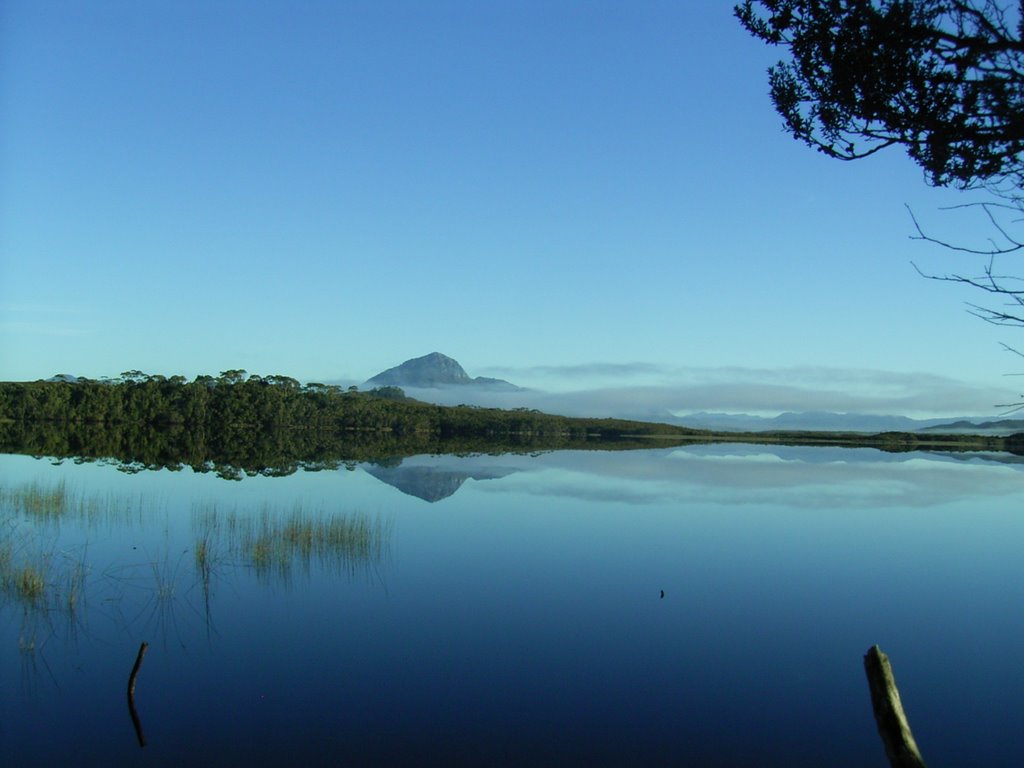
Welcome to our walking Blog. The first few entries are from a recent trip we did in Southern Tasmania- the South Coast Walk from 28th March to 3rd April 2006. On the left is a picture taken at 0730 of Melaleuca Lagoon, just down from the hikers huts. We were astonished by the beauty of this lagoon. It was spectacular, no breeze and a magnificent stillness that was probably the most awe inspiring vista we had ever seen.
To the early French explorers, Southern Tasmania was the world's end. Beyond here they sensed lay only sea and ice. To walk the Port Davey South Coast tracks is to share some of the feeling. There are no roads, no power lines and few modern conveniences. You are walking to the southern end of extremity of an island at the world's end. This is wilderness.
The South Coast Track follow a route used by Tasmanian Aborigines, the track runs from Cockle Creek to Melaleuca in the Southwest National Park. Walkers traverse two mountain ranges, wade several rivers, cross a lagoon by dinghy, negotiate many swampy plains and wander remote and lonely wilderness beaches.
We undertook the walk from Melaleuca to Cockle Creek for the usual reason, to ensure that if we were delayed by bad weather it would be in Hobart waiting to get in, not Melaleuca waiting for a flight to get out.
There were 4 in the party Frank and Sue, Colin and John. There was a significant variation in experience within the party and this proved for some interesting challenges during the seven days. This was mainly due to speed of walking and communication. We would strongly suggest that if you walk with a group with a very wide difference in speed that you stick together or meet at predetermined points. Alternatively, make clear plans if some of the group don't make it to camp before dark.
Alternatively, we had a fantastic time together where the experience and the hardship will live in our memories for a long time. It has also wetted our appetites for some more wilderness, multiday walking.
Day 1 - Hobart - Melaleuca - Cox Bight - 28th March
An earlier flight than expected saw us flying over towering mountains as the sun rose. Their peaks reflected in lakes suspended between them, the valleys below shrouded in fog. We had wonderful views of Mount Anne, the Arthur Rangers and Federation Peak. We landed on the very short runway at Melaleuca, bought gas and had a quick look around before heading for our first nights destination, the Point Eric Campsite on Cox Bight. This is a few hours level walk south through a broad button grassed valley. The track then follows the course of Moth Creek and then the base of the harborbour Range, round Freney Lagoon and eventually leads to Cox Bight, which is broken by Point Eric. 
This short day gave us the chance to get used to carrying heavy packs, the opportunity to explore beach on arrival and recover slightly from the rigours of just getting here. We were blessed with beautiful warm weather and clear blue skies. Yummy dinner of devilled sausages and veggies – thanks Colin. On the way we met four walkers who pleased to know that their food drop was at Melaleuca. 
Above is the view towards Cox Bight. What fantastic weather!!
To the right is the campsite , right on the beach at Point Eric. A truly beautiful location.
Related Posts
South Coast Track - Point Eric to Louisa River
South Coast Track - Louisa River to Deadmans Bay
South Coast Track - Deadmans Bay to New River Lagoon
South Coast Track -New River Lagoon - Surprise Bay
South Coast Track - Surprise Bay to South Cape Riverulet
South Coast Track - South Cape Riverulet to Cockle Creek


No comments:
Post a Comment