
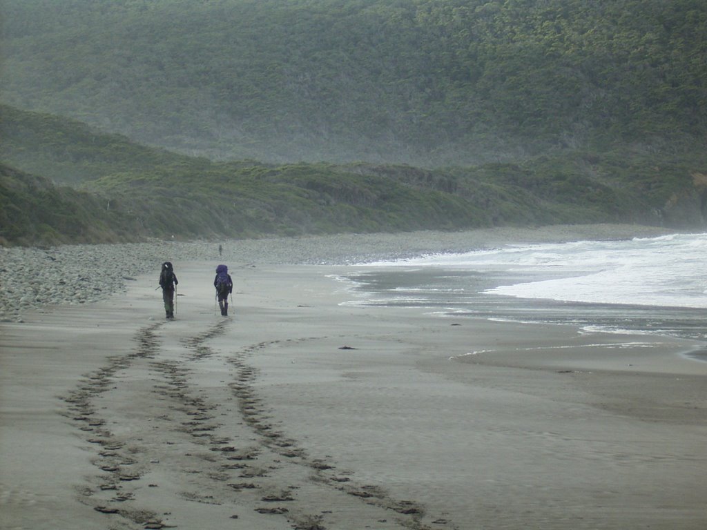
 The day began with a steep climb up over the ridge then down the through the forest to Granite Beach.(see picture left) It is necessary to boulder hop to the eastern end of the beach then climb, a small (but scary) cliff near the water fall. There is a campsite at the top of the cliff. There is then a long ascent to Flat Rock Plain as the track climbs to the top of the South Cape Range. Some very muddy sections, through forest, must be traversed before the descent to the button-grass opening of Blackhole Plain.
South Cape Range is arduous to cross with boggy sections and buttress roots to negotiate. As darkness closed in and with uncertainty of how much further we had to go before reaching South Cape Rivulet we decided to stop at the next clear spot put up the tent and stay the night. This left Colin and John seperated from us, slightly worried, camping at the Rivelet. Following a qu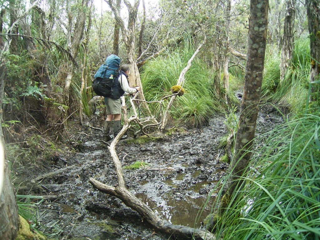 ick dinner and wash it was time for bed.
We slept OK in the middle of the very dark forest and awoke before dawn, had breakfast and were on our way by 7:00am. We met Colin coming in to meet us and he seemed very relieved to know that neither of us were injured (just slow)
This event triggered us to decide to purchase a GPS as we were unsure of how far the campsite was from us when it got dark. Colin has one but he was generally 1-2 hrs ahead so it was basically useless to us. The standard map for this area is 1:100,000 which does not show much detail. There are 1:25,000 maps but you require 5 for the whole walk...too many to carry.
Related Posts
South Coast Track Tasmania
South Coast Track - Point Eric to Louisa River
South Coast Track - Louisa River to Deadmans Bay
South Coast Track - Deadmans Bay to New River Lagoon
South Coast Track -New River Lagoon - Surprise Bay
South Coast Track - South Cape Riverulet to Cockle Creek


No comments:
Post a Comment