Showing posts with label South Coast Walk. Show all posts

Hiking gear - learning from your mistakes and fixing them

Have you ever returned from a hiking trip and thought?

- never again, it is all too hard, too heavy and too difficult
- my pack was loaded badly
- my tent was too heavy
- my food was awful

Matthias, a fellow blogger and mate at Matt Worldwide posted a fantastic , detailed analysis recently on the lessons he has learnt from his first two Australian bushwalks.

A very thoughtful and thorough blogger, Matthias has put together a long post about his preparations to undertake the South Coast Track in Tasmania over Easter. We highly recommend you read his full post Preparing for a 10 day hike in South West Tasmania

Here are a few of the key points he has identified and tried to fix. We will look forward to his post trip report to determine if he has been successful!!


Mark at Louisa Bay - strapping on his gear - he carried around 30kg and regretted it!

- My backpack was badly set up and caused me pain in back and shoulders.

- My backpack was too heavy, I carried too much stuff

- I carried too much food, and what I carried was too heavy (e.g. cans or fruit cake).

- I didn’t carry mosquito repellent.

- Cotton clothing, not really suitable for hiking.

- I had blisters on my feet all the time.

- With only a 1 litre bottle I ran out of water sometimes.

- No real rain protection (it was summer so a light poncho-like jacket did the trick).

- Food planning and the positioning of stuff in my backpack in general was too complicated. On most days I didn’t have lunch because I didn’t want to unpack everything. I didn’t carry real lunch food anyway, only snacks, so I simply walked on to the next camp and had early dinner. It didn’t bother me much, once I start walking I can walk the whole day without eating much, but I think it would be beneficial to have a lunch break.

- My tent was too heavy and took up lots of space.

Read Matthias's full post Preparing for a 10 day hike in South West Tasmania, it is great information.


Does all or some of this sound familiar?
It does to us, so we will be keen to read how Matthias' improvements to his hiking gear set up works after he completes the South Coast Track.


We would love your comments about how you have modified your gear over time and what you would change if you could.

Related Posts
Best hiking clothes for a multi day trip
Hiking gear - what are the basics?
John Chapman's advice for beginners

Continue Reading ....

Port Davey Track - Trip report

"On one night when I was bunkered down in Watershed Camp I was woken up by what I thought were earthquakes but figured out finally that it was the roots of the trees moving in the gale (which worried me somewhat) "

"I couldn't find anyone at Melaleuca and spent my time waiting for the re-supply wandering around, staying out of the weather and watching the birds and a fairly tame wombat. As the days passed without a plane the wombat was starting to look very appetising. "

These quotes from Larry, our guest blogger, set the scene for his fantastic trip report on the Port Davey Track. He faced tough weather, loads of rain and swollen creeks and did it all solo. We have never met Larry but would love to catch up for a yarn one day. Check out his bio at the end of this post.

As background, the Port Davey Track runs for about 70km between Scotts Peak road (near Lake Pedder and the Scotts Peak Dam) and Melaleuca. It is often completed in conjunction with the South Coast Track, both of which are in the Southwest National Park ,within the Tasmanian Wilderness World Heritage Area.

Below is a screen shot of the route using Larry's GPS points laid over a Shonky Map. We have previously posted about Shonky Maps and how great they are with a Garmin GPS


Here are Larry's reflections on his trip:

Intentions

This walk was originally intended to be combined with the South Coast Track and because of the time of year I scheduled what I thought was plenty of spare time into my available period of leave. I figured that 20 days should give me sufficient time to provide sufficient spare days for rough weather and flooding. As it happened the Port Davey Track took longer than I thought it would and then I had to wait on my resupply food at Melaleuca which caused me to re-evaluate my intention to do the South Coast Track. Prudence led me to fly out from Melaleuca.

So my first lesson in the South West was not to set strict schedules.

The Port Davey Track can be done in three days in summer. It took me eight days and could have taken longer had I not been able to cross Bathurst Harbour when I did. I didn’t hurry but I didn’t slouch along either, hitting median times from those estimated by John Chapman in his walk guide. In winter you don’t get long daylight hours and you have to be prepared to wait. I started the walk on 24 June when it doesn’t really get light enough to walk until 8 am and it is almost dark again at 5pm.

As it happened I struck a period of rough weather which prevented Par Avion flying into Melaleuca for over a fortnight so after completing the Port Davey Track, I had to wait for a few days for the re-supply food. This cut my margins down on time and in the end I decided to fly out with the plane rather than continue on. In hindsight I could have continued on as there was a spell of really good weather and I wouldn't have needed the insurance of spare days but I wasn't to know that at the time. It now gives me an excuse to go back to do the South Coast Track.

Despite some very wet days I had a great time and the scenery and environment really impressed me.

I’d been corresponding with John Chapman and his new guide - South West Tasmania was very helpful and I was very grateful for his efforts in getting it to me before I went. One of the little but significant things that made a difference was his recommendation that I take a small radio to get weather reports from Hobart ABC. That was a last minute purchase and was it was reassuring to know how the weather was evolving. I struck a period where there were almost constant gales from a strong westerly stream with periodic fronts passing over the west coast.

On one night when I was bunkered down in Watershed Camp I was woken up by what I thought were earthquakes but figured out finally that it was the roots of the trees moving in the gale (which worried me somewhat).

I took food for eight days and had to spin out my emergency supplies for a further three days while waiting for the Par Avion flight. I always take more than I need and usually grumble at the end of walks when bringing back unused food. This time though I was glad I'd done so.

Trip Report
Day one wasn't a full day and I walked into Junction Creek. I camped about a kilometre past it in a campsite John Chapman recommended.

On day two I walked to Crossing River. It was a fairly wet day so I wanted to get across the river before it came up too far which I managed. I couldn't find the log or rope that is in John’s guide despite having a good look up and down the river from where the track meets Crossing River.

I figured I'd have to swim the river but it was (just) wade-able without my pack and so I did so and towed my pack across on a rope after getting to the other side. I camped at what John indicated was a dry campsite on the next creek but woke to a very swollen creek and water lapping at each end of my tent which galvanised me into action in the dark. The creek had come up over a metre overnight.

Day three to Watershed Camp was an amazing day. It blew a gale and I got a tremendous amount of hail which carpeted the ground. I couldn't believe the lightening and thunder. I'm not unfamiliar with some big storms but with some of the close strikes, the clap of thunder made me jump even when the lightening alerted me to its inevitability. I was glad to get to Watershed Camp which was very damp and muddy even in the cleared patch deeper in the forest where water was streaming across most of the cleared area.

I spent Day four there also while I waited out the storm. I’m not very good at waiting and watching leeches crawling over the outside of the inner tent trying to find a way in palls after a few hours.

Day five (Watershed camp to Spring River) dawned very windy but rain free. It was cloudy but with fairly long patches of blue sky. That was a really nice day of walking and the scenery was majestic. The creeks were very high and I had to swim a few times. At the end of Lost World Plateau I could see the Spring River boiling (I could even hear it surprisingly despite being at least a kilometre and a half away). There was an awesome 200m waterfall on the other side of the river pouring down a big face and I was very upset I didn't have my camera working.

Because this was a day without rain I figured I'd be able to cross Spring River and pushed to do so thinking I could camp in Forest Camp further down. When I finally got to Spring River I had a waist-deep wade though strongly flowing water even to get to the river bank and there was no way I was going to be able to swim it. It was really roiling and I couldn't see the log which John’s guide indicated was there. So it was a retreat to a campsite and another day wait.

The enforced rest day was relatively rain free (only intermittent light showers) and when I hit the track the following day (day seven) I was amazed that what was previously a waist deep wade to the river bank was now only a normal calf-deep mud slosh. The river had dropped I guess an impressive three or more metres and not only was the log apparent but there was a rope tied about a metre and a half higher. I managed to cross without even getting my boots wet by river water.

It is a really nice walk down to Bathurst Harbour from Spring River and I had a relatively nice day to do it. There was a howling Northerly wind at my back but not that much rain and the clouds were only obscuring the higher peaks and then not all of the time. I knew that another front was coming and I could see the dark clouds gathering to the west so I pushed it down to Bathurst Harbour thinking to cross using the Northerly wind before the front hit and it turned westerly. I managed to do so with the smallest of margins. Just as I was securing the boat from the final crossing the front hit with a bang and a big hail storm. Within fifteen minutes I wouldn't have wanted to risk the crossing. I had to get water from the next creek and had a wild time trying to stay on the track as the gale tried to dump me off the isthmus.

If I hadn’t been able to cross when I did I think I wouldn’t have been able to do so for another two days at least.

Day eight saw me push through to Melaleuca in a wild storm. I couldn't believe the amount of water on the track and I had to swim a few creeks and fight the wind-chill in the hail storms and rain. I know about mud but I've not had to fight it before like I did on that day. I had a few falls and damaged one of my walking poles in one of the mud holes which worried me for the South Coast Track as I now rely on poles a lot.

It was nice reaching the walkers huts at Melaleuca and to be able to dry off and get into warm clothes. I couldn't find anyone at Melaleuca and spent my time waiting for the re-supply wandering around, staying out of the weather and watching the birds and a fairly tame wombat. As the days passed without a plane the wombat was starting to look very appetising.

All in all I had a great time. In the eleven days down in the South West I never saw anyone else and had the track to myself. I'm really looking forward to coming back to have a go at the South Coast Track and will have to find some time to do it as soon as I can.

I lost the track a couple of times, never seriously but it cost me some time figuring out where I needed to go. The first time was on the third creek below the Lost World Plateau. Approaching this creek is a braided track where previous walkers have tried to skirt mud holes. With the water on the track this was a thigh-deep wade at the time. Someone has created a relatively recent but very distinct track through scrub to the river east of the main track which I took thinking it would re-join the main track. Instead it leads to a deeper part of the river which had me swimming the river but finding no track on the other side. I had to back-track and find the proper route to the creek crossing where it was only a chest-deep wade across the creek.

Those reading John Chapman’s Guide will identify the creek I mean. The other time I lost the track was just south of the Bathurst Harbour crossing down from Joan Point as the track along the isthmus enters the forest. Someone has gone to some trouble putting tape along a track down to the creek where water is available but it is not at all clear where the track on goes. I stumbled around for about half an hour looking for the track on and finally resorted to the map and my GPS.

Interestingly I navigated to where I thought the track should be without seeing it. As I normally do I tried then to figure out where I would have put the track if I was making it and discovered that I was standing within two metres of it but couldn’t see it until I was almost on it.
Above is a Google Map image of the final leg of the trip. You can see the airstrip at Melaleuca in the bottom right hand corner.

Background on Larry by Larry:
My first solo walk was as an 11yo when my parents allowed me an overnight walk up the Gascoyne river east of Carnarvon and I’ve been walking since then, never avidly as walking itself has usually been a means for something else, photography, bird watching, getting into country that I wouldn’t otherwise be able to see etc.
I’m 56 now and the most strenuous walks are or soon will be out of my reach so I have a bit of a schedule to do what I can while I still can. I’ve been eyeing off the south west of Tasmania for a number of years now, having made winter trips to the Labyrinth, the Walls of Jerusalem, the Overland track, and one precious one with my wife from the Walls down to Junction Lake, through the Never Never to Lake St Clair.

I don’t mind walking on my own and prefer not to combine wilderness with crowds so off-season walking appeals. I’m from WA and my favourite walks in that state are the ridge walk of the Stirling Ranges and the Point Nuyts Wilderness Block.

Larry is very happy for "Our Hiking Blog" readers to contact him if they have any questions about the walk. His email address is forbes at iinet dot net dot au (remember to remove the dots and replace with .'s etc)

Related Posts
Larry's Gear Ideas for the Port Davey Track
South Coast Track
Food suggestions for a 9 day hike


Continue Reading ....

Starting off hiking? - John Chapman's advice for beginners

Do I rush out and buy all the hiking gear I need? Flog the credit card buying something I don't know enough about? John Chapman has a different view: join a Bushwalking or Hiking Club.

John Chapman, Australian hiking guru and leading author has kindly agreed to be the second guest poster in response to Megan's question: Hiking Gear - What are the basics to get started?

John has just sent the 5th edition of his guidebook South West Tasmania to the printers. It will be ready for release in June 2008. It is a highly recommended resource. See below for more details about "South West Tasmania".

This is John's response:

It is quite easy - tell her to keep her credit card in her pocket at the moment - yes, some things are expensive, but if you need them they end up being cheap, but you certainly don't need everything.

Suggest she goes along and joins one of the bushwalking clubs and goes on some overnight walks with them - yes most clubs do mainly day walks but the bigger clubs all have a number of keen overnight walkers.

She can hire gear from the club like a tent, sleeping bag, rain jacket and pack and maybe other items and she can learn from her experience and also see how others do it and adapt the things she thinks would work for her.

It's also a good way to get some experience quickly and also possibly meet some other like minded people. Tell her that while most clubs will often do day walking only, just ask to see the overnight walk program. It there are are overnight walks on the program then she will know they have a core group of overnight walkers.

She should not shell out lots of cash until she knows what she wants and needs. Also tell her good equipment will normally last between 10 and 20 years so its worth getting the best for her needs (not always the most expensive) as it ends up cheap in the long run.

Bushwalking Victoria is the peak body for all bushwalkers and bushwalking clubs in Victoria, Australia. There are many bushwalking clubs where you can meet like minded people.

In addition, most Universities have Bushwalking or Climbing Clubs. John was involved in the Melbourne University Mountaineering Club (M.U.M.C). As he notes in an email to "Our Hiking Blog"

If she is at Melbourne - the logical choice is MUMC (Melb Uni Mountaineering Club) - they are very active and have lots of gear to hire and go lots of places. I was once climbing convener then treasurer of that club years ago and am a life member - I have occasional contact and they will help her out lots - don't bother with the other clubs. The club rooms are open at lunchtime at the north end of the ovals close to St Hildas College, the student union or sports union will help her to find them if she has trouble.

South West Tasmania by John Chapman
The 5th edition of this guide book is currently at the printer and is scheduled for delivery on June 2nd 2008. The new edition is a major upgrade from earlier editons - the guide has 224 pages (last edition had 192) and has 141 colour photographs (previous edition had 75 black and white photos). New additions are colour topographic maps for all major tracks and routes and gradient profiles for all major tracks and routes. New areas included are the Picton Range and also an expnasion of brief notes of harder or lesser known walking routes. Overall the new guide describes about 200 days of walking (the previous edition described 125 days).

Previously published in 1976 (note form on A4 paper), 1978, 1983, 1990 and 1998. Covers all the main tracks and routes in South West and Wild Rivers National Parks in Tasmania. This covers the southern half of the Western Tasmania World Heritage Area. Track notes for the northern half are in another guide, Cradle Mountain Lake St Clair National Park. Contains comprehensive track notes, brief background notes on history, botany and geology, comprehensive planning and preparation notes and access details.

Walks described are South Coast Track, South West Cape, Port Davey Track, Huon & McKays Tracks, Precipitious Bluff (Southern Ranges), Picton Range, Federation Peak and approaches (Eastern Arthurs and Farmhouse Creek), Western Arthur Range, Mt Anne, and Frenchmans Cap. Included as brief planning notes are the West Coast (Strahan to Port Davey), the Frankland Range, the Denison, Spires and King William Ranges and also a new section of Other Routes which includes Mt Hopetoun, Old River to Federation Peak, White Monolith Range, Vanishing Falls, Mt Norold and the Prince of Wales Range.

Related topics:
Hiking Gear - the basics
Hiking gear - what are the basics to get started?
Couple Hiking? Gear ideas for starting off on the right foot together


Continue Reading ....

GPS - Waypoints and Tracks - Tasmania Overland Track, South Coast Track , Great Ocean Walk, Thorsborne Trail

Searching for GPS track or route information about Tasmania and other areas in Australia including Hinchinbrook Island, (the Thorsborne Trail) and the Great Ocean Walk?
We often get searches on "Our Hiking Blog" regarding this information, but are rarely contacted, so we decided to post and declare our willingness to share this information with anyone who takes the time to email us.

Erik Charlton trying to get a satellite on his GPS at the North Pole

We have been using a Garmin eTrex Legend Cx GPS for the last few years and have all the track files and waypoints from each walk we have undertaken since that time. You will probably need Mapsource to read the files.

So, if you are planning a walk in any area covered in "Our Hiking Blog", send us an email or read our post Which GPS for Hiking?

Continue Reading ....

Food - a menu for 9 days hiking

Lightweight food for a 9 day hike?
Making sure you are not bored with your hiking meals?
Some great ideas to keep you fuelled up on an long bushwalking trip?

What food to take on an extended hike is always something that challenges us before a trip. Balancing weight, freshness and variety all make for interesting discussions as we plan our menus. We are always on the lookout for new or well written information about hiking food so please contact us here if you would like to contribute.


Photo by Super Starfish ..dining outdoors


Tasadam, from the Bushwalk Tasmania Forum ,submitted an excellent post on that forum regarding the food his wife was taking on a 9 day walk on the South Coast Track in southern Tasmania. The link to the full topic on the forum is here.

We asked Tasadam if it was OK to reproduce the menu and he was happy for us to make it available for "Our Hiking Blog" readers.


We did the South Coast Track in March / April 2006 and this is the link to our posts. If you want to read Sue's reflections and check out the pictures, have a look.

This is the list of food Tasadam's wife took on the walk and his thoughts:

Breakfast - x 9
Her normal cereal which is Fibre Plus - 60 gram serves which is a cup full. Weighed into individual Multix medium sized freezer bags (these are the best and lightest bags).
Milk powder - 9 x 30 gram bag fulls, cheap & nasty Coles freezer bags, tied into a knot then the tails cut off. All together in a Glad sandwich bag.Also, 20 tea bags, a quantity of milk powder in a bag for extra cups of tea, and a small bag of sugar.

Total for 9 x Breakfast with mentioned extras = 983 grams. 109 grams per day.

Dinner

The expensive freeze dried single serve bags that you get in the bushwalking shops. Approx 110 grams total.
Also, a quantity of dried beans and some cuppa soups.


Total for 8 dinners plus extras = 1047 grams. 131 grams per day.


Lunch - a bit more tricky but still managed okay
Mountain Bread, 8 sheets plus bag = 250g.
Thickly sliced cheese enough pieces for each day= 274 grams
Stick of salami = 317 grams
Semi Dried tomatoes in a sandwich bag with oil drained off = 88 grams
Mango chutney in a food tube as a spread = 109 grams
Carrots * 2 - cut into quarters (1/4 carrot per day x 8 days) = 220 grams

Total for 8 lunches = 1258 grams or 157 grams per day.


Nibble bags
8 bags of nibbles consisting of dried fruit (fruit cake mix - sultanas, raisins, fruit pieces etc), dried apple, scroggin (bushwalkers mix from Wholesome house, Deloraine - I swear by that stuff), Dried banana, sweetened dried banana, dried apricots.

Total = 983 grams or 117 grams per day


Extra food -
Full packet of GingerNut Snaps = 270 grams
Half a 200g block Toblerone chocolate (one piece per day) = 110 grams
Bag of cashew nuts = 100 grams

She also had 3 x 75 gram portions of Sustagen powder to make 3 x half litre energy drinks = 225 grams.

Total extras 705 grams or 88 grams per day average.


Total food weight for 9 breakfasts, 8 lunches and 8 dinners plus all the extras = 4976 grams.
Total per day = 608 grams.

And she carried a chicken salad roll for a couple of hours on the first day to have a luxury lunch.

Total weight could be cut down by -
Losing the carrots - new daily total 580 grams
And talking only half a packet of biscuits New total 563 grams
And lose the sustagen powder (if it's not your thing) New total 555 grams.

Wouldn't want to go too much more extreme than that - lots of energy burnt up when walking.

EDIT - A bit of follow up from Tasdam.
The sundried tomatoes weren't such a hit, still too sloppy...
The bushwalkers mix of nibbles, there are similar bags of stuff you can buy in the supermarkets - easy to spot - with the nuts etc in the fruit and veg section. Pre-packaged in a 400 gram bag. Walnuts, almonds, sultanas, dried fruit, seeds - I think they are pumpkin and something else, etc you get the idea. But I think I prefer the stuff from Wholesome house more... It tastes "better". This stuff keeps you regular too. I find about 100 - 120 grams a day is enough.

Many thanks to Tasadam, we think it is one of the best food lists for a multi-day walk we have come across.

Just a reminder to checkout and join the Bushwalk Tasmania forum. It is an excellent resource for anyone who loves (or dreams about) walking in Tasmania. There are also some fantastic pictures that have been posted by the members there showcasing some of Tassie's most beautiful wilderness scenery .


Related Posts
Hiking Food- a menu for 9 days
Dehydrating a curry for a multi day hike
Vegetarian Hiking food ideas
Meal ideas for the Overland Track and other long hiking trips - Part One
Meal ideas - (Lunch and Dinner) for the Overland Track and other long hiking trips - Part Two
Spagetti Bolognase - a great inexpensive meal to dry for hiking

Continue Reading ....

Great Ocean Walk - Gaiters

We received a question from Ivor about the Great Ocean Walk in South Western Victoria.
He asks: I'm walking the GOW next week, as a man who is used to walking in Scotland and Tasmania I never leave home without my gaiters. I'm aware of the river crossing on the GOW but are the tracks soooo muddy that I need to take gaiters with me? I was thinking of getting some short ones just to keep sand out of my boots.

Any suggestions?

We did the Great Ocean Walk in May this year. Here is the link to the first of six posts about the walk. We did not take gaiters on the GOW, and would suggest they are unnecessary.


There is really only one (semi) serious river crossing on the walk. It is half way up Joanna Beach. The crossing is fairly tide dependant and depending on your timing or inclination to take your boots off you should be OK. Most of us just waited for the waves and did a fast runner.

As regards gaiters for the sand. I would not worry about it. When you are on beach , the best walking is on the damp sand , just above the waves where it is harder. You don't seem to get much sand in your boots in that area.

There MAY be some argument for wearing gaiters in warm weather as protection from snake bite. They are fairly common in the area, so it is worth keeping a good lookout for them. This is always a toss up as the tracks are generally well maintained and open so you usually have good vision a couple of metres ahead!!

In May, the mud was more just the odd spot of slimy clay, nothing like in Tasmania. If you want to see REAL mud check out this post . The Otways is nothing like the wilds of Tasmania!

We nearly always wear gaiters in Tassie because of the muddy sections or if we are bush bashing. The track on the GOW is VERY well defined and unless you have the staggers you would be hardpressed to hit a sharp branch!! Would be interested in hearing your opinion on walking the 4WD sections of the track. There is a fair bit of it.

Just a word of warning, I not sure what you do about carrying water but supply is limited between each campsite. This is certainly unlike Tassie where you can usually find some within a couple of hundred metres of thinking you need to top up. We strongly suggest taking enough for the day when you leave each morning. Supplies at each campsite are usually abundant.

Continue Reading ....

South Coast Track - Tasmania - South Cape Rivulet - Cockle Creek - 3rd April


Following our night in the bush away from Colin and John we had another short climb and then a forest descent before we emerged at South Cape Rivulet. Colin had come to meet us and we learned he had sent out search parties until quite late in the evening. We never saw or heard any of this as we had been tucked down next to a small, noisy stream and had finished dinner and were in bed by 7pm. Above is Sue, very early in the morning just after we arrived at South Cape Rivulet. The tide was well out, Colin and John were concerned the previous evening because the tide was in and the flow higher. It could have made for a difficult crossing.


South Cape Rivulet can be a difficult river crossing but fortunately the tide was low and the water only knee deep. (On picture, it is the furtherest bay) It was running quite swiftly and there were some deep holes but we felt for them with our feet moving slowly,avoiding the really deep sections.

The views of the seas along this section of are truly stunning, best of all, South Cape with its distinctive sudden drop-off near the end. At one point three Shy Albatross soared over head as we walked along the beach. The track crosses a series of beaches and headlands until steep steps lead up to Coal Bluff overlooking South Cape Bay and Lion Rock. Just past Lion Rock the track reaches the last beach on the South Coast Track. Due to close proximity to Cockle Creek the track from here is well constructed and obvious. From the eastern end of the beach there is a climb up and around the rocky headland with a view across South Cape Bay, then traverses the coastal scrub and heath of Blowhole Valley to the road head at Cockle Creek.

The last couple of hours felt like hell as we trudged towards Cockle Creek. After all the hard yakka we had endured over the last six days this section was probably the easiest but the pressure to reach the END weighed heavily in our minds. There was a lot of duck boarding and this proved pretty hard on our feet as we had been used to walking on much softer (read mud here) track.

We started to meet day walkers about an hour out from Cockle Creek and were overwhelmed by their perfumed smell and cleanliness. Phew, some of it was strong as we passed them. It was quite strange to see others who were clean and fresh looking.

Cockle Creek is a great place. It is a very small, spread out hamlet with a few houses, a Rangers Station, public phone and a few tourists. We all straggled in (Colin first of course) and slowly started to acclimatize to people, different noises and smells.

We had arranged our own bus back to Hobart and he turned up right on time. We had thought that the normal bus service was finished for the year and were surprised to see the bus waiting when we arrived. We were happy to have our own bus (for about the same price) and were back in Hobart well before dinner. Enjoyed a really nice hot shower and then a great feed at the Shippies pub in Battery Point

It is a great Pub, right in the middle of Battery Point. The beers etc all went down pretty well as we sat around debriefing ourselves and enjoying the sense of achievement of completing the South Coast Walk.


At Cockle Creek....Colin, John, Frank and Sue - happy to be out, maybe sad it was over.....

Related Posts
South Coast Track Tasmania
South Coast Track - Point Eric to Louisa River
South Coast Track - Louisa River to Deadmans Bay
South Coast Track - Deadmans Bay to New River Lagoon
South Coast Track -New River Lagoon - Surprise Bay
South Coast Track - Surprise Bay to South Cape Riverulet

Continue Reading ....

South Coast Track - Tasmania - Surprise Bay - South Cape Riverulet - 2nd April

The day began with a steep climb up over the ridge then down the through the forest to Granite Beach.(see picture left) It is necessary to boulder hop to the eastern end of the beach then climb, a small (but scary) cliff near the water fall. There is a campsite at the top of the cliff. There is then a long ascent to Flat Rock Plain as the track climbs to the top of the South Cape Range. Some very muddy sections, through forest, must be traversed before the descent to the button-grass opening of Blackhole Plain.


South Cape Range is arduous to cross with boggy sections and buttress roots to negotiate. As darkness closed in and with uncertainty of how much further we had to go before reaching South Cape Rivulet we decided to stop at the next clear spot put up the tent and stay the night. This left Colin and John seperated from us, slightly worried, camping at the Rivelet. Following a quick dinner and wash it was time for bed.

We slept OK in the middle of the very dark forest and awoke before dawn, had breakfast and were on our way by 7:00am. We met Colin coming in to meet us and he seemed very relieved to know that neither of us were injured (just slow)

This event triggered us to decide to purchase a GPS as we were unsure of how far the campsite was from us when it got dark. Colin has one but he was generally 1-2 hrs ahead so it was basically useless to us. The standard map for this area is 1:100,000 which does not show much detail. There are 1:25,000 maps but you require 5 for the whole walk...too many to carry.


Related Posts
South Coast Track Tasmania
South Coast Track - Point Eric to Louisa River
South Coast Track - Louisa River to Deadmans Bay
South Coast Track - Deadmans Bay to New River Lagoon
South Coast Track -New River Lagoon - Surprise Bay
South Coast Track - South Cape Riverulet to Cockle Creek

Continue Reading ....

South Coast Track - Tasmania - New River Lagoon - Surprise Bay - 1st April 2006

The track traverses the crest of the vegetated dunes of Milford Creek. The waters of this creek are particularly dark and the ford at this creek can appear much deeper than it actually is. For this reason we decided to take the alternate route and managed to get lost in the bush for several hours. When we emerged from the bush we were back at the top of a steep set of steps that led to Milford Creek. We crossed the creek with ease and continued along the beach at times it some so windy it was difficult to keep walking. At the end of Prion Beach we climbed the wooden steps up to leave the beach and continued through light bush on an open track. We stopped on Rocky Plains, in drizzling rain for something to eat. Again there was lots of mud to go around or simply through, depending on how deep. Frank lost the chest strap from his pack following a fall as he helped me ascend a particularly steep muddy step. The track then climbs through spectacular mixed forest before descending to Surprise Bay.


A pleasant walk along the beach is followed by another creek crossing and a short but steep climb up to the campsite. Sue and John (at left) are ready to cross the last river for the day. It was knee deep and very strong flowing. We crossed it together as the last thing we wanted at that time of the day was to get wetter!


Water was quite easily found from the beach but the campsite was a short , sharp climb up a set of steps.


The rain had stopped and following an early dinner of toasted flat bread sandwiches we were able to sit and watch the sea until it got too cold and dark to do so. This was a great camp site, with spectacular views. A fire place was also provided, which seemed strange in a Fuel Stove Only area.
We were in bed early (as usual) because the next day was expected to be long.


Related Posts
South Coast Track Tasmania
South Coast Track - Point Eric to Louisa River
South Coast Track - Louisa River to Deadmans Bay
South Coast Track - Deadmans Bay to New River Lagoon
South Coast Track - Surprise Bay to South Cape Riverulet
South Coast Track - South Cape Riverulet to Cockle Creek

Continue Reading ....

South Coast Track - Tasmania - Deadmans Bay - New River Lagoon - 31st March


We had been woken during the night not only by rain but a by a creature trying to steal food. The quoll returned in the morning and attempted to steal a zip lock bag containing Frank’s phone and a number of batteries. The rain continued as we packed up. The track crossed button grass plains and sandy Turua Beach before traversing Menzies Bluff and continued through forest, with very deep mud. (see pic left)

This was the start of the serious mud. Up until now most of it had not been encompassed by trees and there were options to avoid some of the deeper sections. Here it was mud or nothing ---up to your bum on occasions.

There followed a steep descent from forest across a small creek around rocky outcrop across sand over rocks to Prion Beach. Prion Beach is probably the most spectacular beach on the south coast, a stretch a sand receding into the sea-haze with the distinct form of Precipitous Bluff rising from the dunes. The deep wide outlet of New River Lagoon must be crossed from Prion Beach and two dinghies are provided to allow this to happen. Frank did the honours. As the weather was atrocious hailing, raining and freezing and and there was a general feeling of unwellness it was decided to spend the night here.

We all took to our beds for the afternoon in an attempt to stay warm and dry. After an early dinner ,all us us hit our beds early as the second hail storm hit. We discovered on our return to civilisation that that night ,Tasmania had been covered with snow down to 900m.


The picture on the left is New River lagoon. The row boat is situated where the red spot is. If you are tired and the weather is poor you could potentially walk up the beach and then have to double back to find it as the lagoon is hard to see from the ocean side.


Related Posts
South Coast Track Tasmania
South Coast Track - Point Eric to Louisa River
South Coast Track - Louisa River to Deadmans Bay
South Coast Track -New River Lagoon - Surprise Bay
South Coast Track - Surprise Bay to South Cape Riverulet
South Coast Track - South Cape Riverulet to Cockle Creek

Continue Reading ....

South Coast Track - Tasmania - Louisa River - Deadmans Bay

Ironbound Ranges?
Steep climbing?
Horrible descent?
Mud, roots, trees and more mud?

yes, this section certainly tested us.....


For the majority of walkers crossing the Ironbound Range is most physically and mentally demanding part of the South Coast Track. The 900 metres climb up the steep exposed western slope is largely without respite. We had perfect weather for crossing the Ironbound Range – not too hot, not too cold. The only alpine vegetation on the South Coast Track is found on the plateau of the Ironbound Range. We were afforded views along the entire coast as we sat and ate lunch on the board walk. We tried to shelter from the very strong and very cold wind behind the tallest tree we could find. Crossing the Ironbound Range is bad weather was not something we could contemplate.

The descent of the south eastern side of the range through dense rainforest was long and arduous. Careful foot placement was necessary due to exposed tree roots and steep steps. Lack of concentration, rubbery knees and shaky legs meant that slipping or falling was always a likely possibility. This was a very long day and we didn’t arrive at the campsite at Deadmans Bay until well after dark.
Just an addition to Sue's notes from above. The "down" on the east side of the Ironbounds is significant. While the vegetation is spectacular, there are limited views, plenty of mud, many track obstructions, huge steps and more mud. It took us about 7hrs following a late lunch (left) to finally reach the camp site at Deadmans Bay. (a fitting description of how we felt)


Colin and John were there to welcome us and we were very grateful to see them as it was very dark.


To the right is a fantastic Google Earth image of the Ironbound ranges. Deadmans Bay is the small white beach in the middle of the picture.

Below is a profile of the Ironbound Ranges taken off Colin's GPS track. Yep, it is around 900m up!

And then 900m of the worst down you would even imagine.


Related Posts
South Coast Track Tasmania
South Coast Track - Point Eric to Louisa River
South Coast Track - Deadmans Bay to New River Lagoon
South Coast Track -New River Lagoon - Surprise Bay
South Coast Track - Surprise Bay to South Cape Riverulet
South Coast Track - South Cape Riverulet to Cockle Creek

Continue Reading ....

South Coast Track - Tasmania - Point Eric - Louisa River

The longest inland section of the walk began with a walk long the beach around a small headland (boots off) to the end of Cox Bight. At Buoy Creek the track leaves the beach and crosses button grass plains before the very sharp ascent of Red Point Hills. There are some campsites here that are not marked on the Parks map which could be used if you wanted to shorten the day. Water supply was excellent.

From the top of Red Point Hills we had extensive views of where we had been and where we were going. There is a gradual descent to Faraway Creek, which was crossed with relative ease. The track then sidles the Spica Hills before crossing the button-grassed Louisa Plains on a lengthy section of board walk. This relatively easy walking allowed us to take in the view, including the ominously steep slopes of the Ironbound Range. It is interesting to read in most journals or articles on this walk the overriding presence of the Ironbounds. We really felt this in the late afternoon as we walked towards their base.

The Louisa River is the largest steam to be crossed by the track; there is a rope to assist. Walkers we had met earlier had had to wait a day for the water level to drop before crossing. Luckily we crossed easily and set up camp for the night and had another yummy dinner of steak and veggies.

Crossing Faraway Creek late Day 2

Colin was our fresh food guru. We took eye fillet steak that had been vacpacked. Probably too heavy but was really nice to eat after a long day. With it was Deb potato and rehydrated corn and peas topped with a great pepper sauce. Well done Colin!

Today was a very long day (17km) and our first exposure to Southern Tasmanian mud. It made mud on the Overland Track look like a kids wading pool!


Related Posts
South Coast Track Tasmania
South Coast Track - Louisa River to Deadmans Bay
South Coast Track - Deadmans Bay to New River Lagoon
South Coast Track -New River Lagoon - Surprise Bay
South Coast Track - Surprise Bay to South Cape Riverulet
South Coast Track - South Cape Riverulet to Cockle Creek

Continue Reading ....

South Coast Track - Tasmania

Hello All,

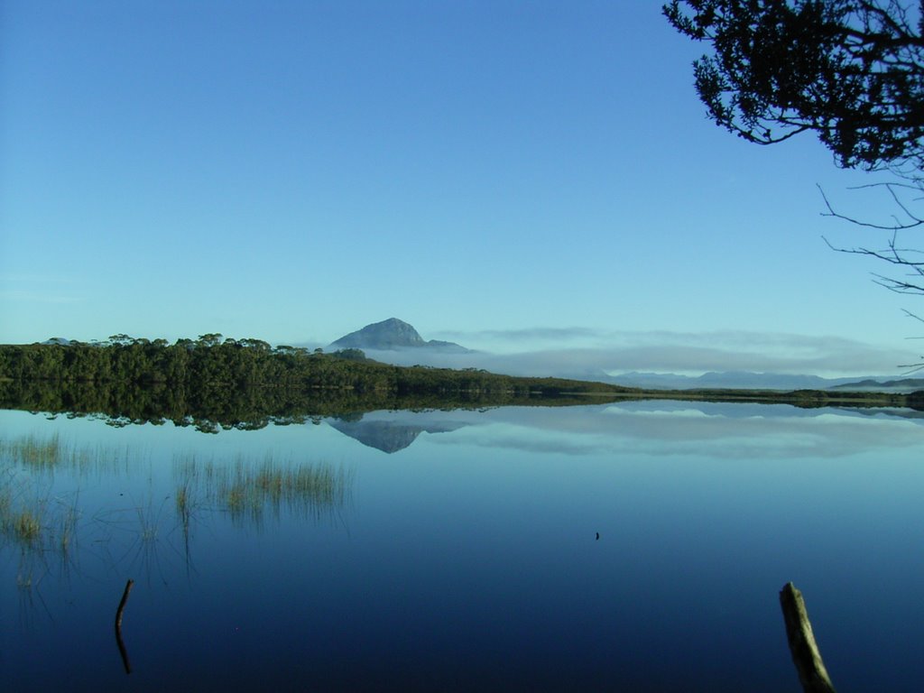
Welcome to our walking Blog. The first few entries are from a recent trip we did in Southern Tasmania- the South Coast Walk from 28th March to 3rd April 2006. On the left is a picture taken at 0730 of Melaleuca Lagoon, just down from the hikers huts. We were astonished by the beauty of this lagoon. It was spectacular, no breeze and a magnificent stillness that was probably the most awe inspiring vista we had ever seen.

To the early French explorers, Southern Tasmania was the world's end. Beyond here they sensed lay only sea and ice. To walk the Port Davey South Coast tracks is to share some of the feeling. There are no roads, no power lines and few modern conveniences. You are walking to the southern end of extremity of an island at the world's end. This is wilderness.

The South Coast Track follow a route used by Tasmanian Aborigines, the track runs from Cockle Creek to Melaleuca in the Southwest National Park. Walkers traverse two mountain ranges, wade several rivers, cross a lagoon by dinghy, negotiate many swampy plains and wander remote and lonely wilderness beaches.

We undertook the walk from Melaleuca to Cockle Creek for the usual reason, to ensure that if we were delayed by bad weather it would be in Hobart waiting to get in, not Melaleuca waiting for a flight to get out.

There were 4 in the party Frank and Sue, Colin and John. There was a significant variation in experience within the party and this proved for some interesting challenges during the seven days. This was mainly due to speed of walking and communication. We would strongly suggest that if you walk with a group with a very wide difference in speed that you stick together or meet at predetermined points. Alternatively, make clear plans if some of the group don't make it to camp before dark.

Alternatively, we had a fantastic time together where the experience and the hardship will live in our memories for a long time. It has also wetted our appetites for some more wilderness, multiday walking.

Day 1 - Hobart - Melaleuca - Cox Bight - 28th March

An earlier flight than expected saw us flying over towering mountains as the sun rose. Their peaks reflected in lakes suspended between them, the valleys below shrouded in fog. We had wonderful views of Mount Anne, the Arthur Rangers and Federation Peak. We landed on the very short runway at Melaleuca, bought gas and had a quick look around before heading for our first nights destination, the Point Eric Campsite on Cox Bight. This is a few hours level walk south through a broad button grassed valley. The track then follows the course of Moth Creek and then the base of the harborbour Range, round Freney Lagoon and eventually leads to Cox Bight, which is broken by Point Eric.


This short day gave us the chance to get used to carrying heavy packs, the opportunity to explore beach on arrival and recover slightly from the rigours of just getting here. We were blessed with beautiful warm weather and clear blue skies. Yummy dinner of devilled sausages and veggies – thanks Colin. On the way we met four walkers who pleased to know that their food drop was at Melaleuca.


Above is the view towards Cox Bight. What fantastic weather!!

To the right is the campsite , right on the beach at Point Eric. A truly beautiful location.


Related Posts
South Coast Track - Point Eric to Louisa River
South Coast Track - Louisa River to Deadmans Bay
South Coast Track - Deadmans Bay to New River Lagoon
South Coast Track -New River Lagoon - Surprise Bay
South Coast Track - Surprise Bay to South Cape Riverulet
South Coast Track - South Cape Riverulet to Cockle Creek


Continue Reading ....