Showing posts with label Thorsborne Trail. Show all posts

GPS - Waypoints and Tracks - Tasmania Overland Track, South Coast Track , Great Ocean Walk, Thorsborne Trail

Searching for GPS track or route information about Tasmania and other areas in Australia including Hinchinbrook Island, (the Thorsborne Trail) and the Great Ocean Walk?
We often get searches on "Our Hiking Blog" regarding this information, but are rarely contacted, so we decided to post and declare our willingness to share this information with anyone who takes the time to email us.

Erik Charlton trying to get a satellite on his GPS at the North Pole

We have been using a Garmin eTrex Legend Cx GPS for the last few years and have all the track files and waypoints from each walk we have undertaken since that time. You will probably need Mapsource to read the files.

So, if you are planning a walk in any area covered in "Our Hiking Blog", send us an email or read our post Which GPS for Hiking?

Continue Reading ....

Thorsborne Trail - Hinchinbrook Island

Just arrived back in Cairns after completing the Thorsborne Trail. Have decided to post a few pictures of this beautiful place. Words and more editing to follow!!
The Start

View from Clare and Tom's tent first morning


Zoe Falls - top with Zoe Bay in distance

Zoe Falls - swimming pool at base


Local wildlife


Nina Bay - late afternoon


Related Posts
Thorsborne Trail – Hinchinbrook Island - prelude
Planning for the Thorsborne Trail
Thorsborne Trail - Planning the walk
Thorsborne Trail - George Point to Sunken Island Reef
Thorsborne Trail - Sunken Island Reef - Zoe Bay
Thorsborne Trail - Zoe Bay to Little Ramsay Bay
Thorsborne Trail - Little Ramsay Bay - Nina Bay
Thorsborne Trail - Nina Bay - Ferry

Continue Reading ....

Hinchinbrook Island - Thorsborne Trail - Day 5

Leg: Nina Bay to Ferry
Distance: aprox 3km
Time : 1-2 hrs at a slow pace

The final day on this delightful trek dawned to our usual fare of bright sunny skies and a nice warm temperature. The walking was relatively easy other than a couple of rocky outcrops and sections close to the beach. We scrambled over these OK as the thought of "real" (read take away here) food was starting to stimulate the salivery glands . Below is the final leg of the journey heading up Ramsay Bay to the ferry pick up point. All details for ferries etc are on this page of the Blog.
The ferry arrived as we had arranged and following a boring wait while some day trippers had a look around, we were taken aboard and whisked back to Hinchinbrook Resort. Great disappointment followed when we were informed the Island was "closed" due to the filming of a Jodie Foster children's movie called Nim's Island. The plan had been to have a leisurely lunch at the resort to round off the trip and then head back to the mainland and Cairns. So, after a quick stop to pick up some of the film crew, we were straight back to Cardwell and real coffee and chips!

The picture below shows us in the pick up tinny, heading through the mangroves back to the large cat that transported us to the Resort and mainland.

The "Crew" top from left - Ken, Frank, Clare & Tom - front Vinnie & Sue


Related Posts
Thorsborne Trail – Hinchinbrook Island - prelude
Planning for the Thorsborne Trail
Thorsborne Trail - Planning the walk
Thorsborne Trail - George Point to Sunken Island Reef
Thorsborne Trail - Sunken Island Reef - Zoe Bay
Thorsborne Trail - Zoe Bay to Little Ramsay Bay
Thorsborne Trail - Little Ramsay Bay - Nina Bay
Thorsborne Trail- Some great pictures of the wonderful scenery

Continue Reading ....

Hinchinbrook Island - Thorsborne Trail - Day 4

Leg: Little Ramsay Bay to Nina Bay
Distance: 3.6 km
Maximum Elevation: 74m
Time taken: 1-2 hrs

Today was almost a rest day as we only had to cover a short distance. It was up late, a wander on the beach and then we packed up and were away by 1030. The travelling was relatively easy to Nina as all our packs were getting light. Vinnie had almost run out of the type of food he liked, so he has having to make hard decisions about what he would and would not eat. Below is the campsite at Nina where we camped under a HUGE tree, again right on the beach.

Beach cricket was enjoyed in the afternoon using a coconut and a palm frond as a bat. We also had several games of bocce using the plentiful empty coconut shells. It was great to have arrived early and to have the whole afternoon to enjoy the beach and the fantastic scenery.
It was a late night for the Hiking Bloggers as we tried to listen to the Geelong / Collingwood preliminary final. We had taken a small radio and speakers just for this momentus occasion. Unfortunately the reception was awful and we only heard one minute in ten of the broadcast, the tension was huge as the game was very close and we paced up and down Nina Bay with the radio held in the air trying to pick up a Sydney radio station!! We finally heard the result 10 minutes after the game had finished and going to bed that night, knowing Geelong would be in the Grand Final the following Saturday, topped off our last night on the island. Go Cats!

Related Posts
Thorsborne Trail – Hinchinbrook Island - prelude
Planning for the Thorsborne Trail
Thorsborne Trail - Planning the walk
Thorsborne Trail - George Point to Sunken Island Reef
Thorsborne Trail - Sunken Island Reef - Zoe Bay
Thorsborne Trail - Zoe Bay to Little Ramsay Bay
Thorsborne Trail - Little Ramsay Bay - Nina Bay
Thorsborne Trail - Nina Bay - Ferry
Thorsborne Trail- Some great pictures of the wonderful scenery

Continue Reading ....

Hinchinbrook Island - Thorsborne Trail - Day 3

Leg: Zoe Bay to Little Ramsay Bay
Distance: 10.4km
Maximum Elevation: 90 metres
Time: about 6 hrs but at a slow pace with lots of stops

We got on the track quite early as this is one of the longer legs of the Thorsborne Trail. The first part of the track is along the beach and was very pleasant walking in the early morning. The picture below is Ken & Vinnie heading along Zoe Bay with Mt Bowen in the distance.

The track then goes inland through a long section of rain forrest that skirts a large mangrove area. This was very pleasant walking except for a couple of areas where the track markers were not clear and the ground quite boggy. This area would be a challenge in "the Wet" as it is low lying and would have become very muddy. There were two river crossings,while easy for us, would be quite challenging following heavy rainfall. Below is the first river crossing. We guessed that in the wet the river could be one metre deeper. That would be a serious crossing.

Walking had become quite laborious as we skirted the low lying mangrove area and headed back into the rain forest. We were quite surprise with the landscape in one section at the back of the mangroves. It was quite open, dry and very hot in the late morning sun.Following a short rainforrest section we came across a very small swimming hole and a few of us had a rinse. It was the size of a large spa but, as with all rivers on the Trail, the water was beautifully clear and cooling. Below Clare is catching up with another walker we met. The swimming hole is at the base of the "Falls". We stopped here for lunch and were rewarded with some great wildlife.

Below is a Tree Frog that was sleeping in the tree above our lunch spot.

This Lace Monitor Lizard was very relaxed. We watched it wander across the top of the fall, stopping to see what was going on, and then make its way down the walking track to near our lunch spot. Clare took photo's within one metre of the dozing reptile.... It was almost a metre long and showed little fear of humans.

Following lunch we headed off towards that evenings camp site. There are two options here, Banksia Bay or Little Ramsay. We decided on Little Ramsay as other walkers had told us the water supply was better at Ramsay. There were also reports that Banksia had more sandflies so that put us ALL off.

Below is a picture of a small beach between Banksia and Ramsay. The track heads up and over the small headland to Ramsay. As you can see, everywhere you look on Hinchinbrook is magnificent.

Ah, to be young and fit! Clare and Tom running back to meet the oldies after dropping their packs at the campsite

So what did we do when we got to camp? We swam, and swam and swam. The water was magic. The view was magic. The company was great.

Sitting on the beach at sunset reading a book was also a favourite pastime. Once you got over the sandflies, the March Flies and mozzies.....we must have gone through a litre of insect repellent.
Related Posts
Thorsborne Trail – Hinchinbrook Island - prelude
Planning for the Thorsborne Trail
Thorsborne Trail - Planning the walk
Thorsborne Trail - George Point to Sunken Island Reef
Thorsborne Trail - Sunken Island Reef - Zoe Bay
Thorsborne Trail - Little Ramsay Bay - Nina Bay
Thorsborne Trail - Nina Bay - Ferry
Thorsborne Trail- Some great pictures of the wonderful scenery

Continue Reading ....

Hinchinbrook Island - Thorsborne Trail - Day 2

Leg: Sunken Island Reef to Zoe Bay
Distance: 6.9.km
Maximum Elevation: 232 metres

The sunrise was wonderful at Sunken Island Reef and the shot below from Clare and Tom's tent showcases it beautifully. Clare's pack can be seen hanging from our rat rope, which is effectively a strong (but light) rope threaded length wise through two softdrink bottles. The theory is that even though the rats can easily tightrope walk along a rope, they can't get over or around a slippery , plastic bottle! We carried bottles and rope for this purpose and had up to 5 packs hanging off one rope without any rat attacks!

Below is the campsite, looking out to the Bay, there was plenty of room, but a lot of rubbish!


It was a big grunt uphill back onto the Thorsborne Trail from Sunken Reef Bay and, in retrospect, it was a toss up whether it was worth the side trip, compared with staying at Mulligan Falls. Mulligan Falls camping area was quite large and close to the Falls so a freshwater swim could be had at any time.

Our next objective was Zoe Falls and the walking was relatively easy. Just as we were getting hot again and looking for a swim, we came across the top of Zoe Falls. We had thought that Mulligan Falls was an excellent swimming hole until we came across the top of Zoe Falls. It is a great swimming hole, with spectacular views down to Zoe Bay. THIS is the spot that is shown in all the guidebooks and is a wonderful spot, one of the highlights of the trip. We stopped there for 2 hours having several swims and a nice long lunch break.

The pictures below show the swimming hole with Zoe Bay in the distance. The second picture is from the top of Zoe Falls. This would be very difficult and dangerous to cross in the Wet or if the river was flowing strongly. In fact, all the river crossings would be dangerous in wet weather as the rocks are very slippery.


We then moved on down a steep track to the base of Zoe Falls. The one minor obstacle is a very short section of climbing down some rocks. Parks have kindly installed a thick rope to help with the descent (or ascent). The drop is about 3-4 metres and Sue, who hates heights and slippery rocks, did it easily. About 10 minutes later, the BEST swimming hole on Hinchinbrook Island that we were to encounter, was revealed at the base of Zoe Falls. It is a large, deep hole with lots of inquisitive Jungle Perch gently cruising in the water. We stopped again and had a great swim. Clare tried diving to the bottom of the pool and was unable to reach it!

From here we made our way down to Zoe Bay and found the campsite. The camping area here starts in very sheltered rain forest, about 150 meters from the Beach. Try and remember to fill your water containers up at Zoe Falls, as the closest point where you can get fresh water and reach the river is about 3-400 meters inland from the Beach.

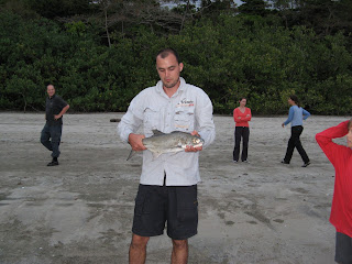
Some great people from Maryborough , in Southern Queensland we had met at the top of Zoe Falls , suggested the best camp sites were hidden off the beach. We found our site (pictured below), which was just off the beach, with a great view and a table! Sand flies were very prevalent. Later in the afternoon a couple of the boys from Maryborough were casting lures into the area just behind the shore break and were able to catch (and release) several salmon. Pretty keen fishermen to carry in their rods as part of their hiking gear, but they were not the only people we saw enjoying a cast and landing a few fish on this trip. keep that in mind any keen anglers out there!
We had a pleasant evening at Zoe bay, met several very nice people and enjoyed the table to cook and eat around. Top spot, worth a couple of days if you can squeeze it in to your trip.
Related Posts
Thorsborne Trail – Hinchinbrook Island - prelude
Planning for the Thorsborne Trail
Thorsborne Trail - Planning the walk
Thorsborne Trail - George Point to Sunken Island Reef
Thorsborne Trail - Zoe Bay to Little Ramsay Bay
Thorsborne Trail - Little Ramsay Bay - Nina Bay
Thorsborne Trail - Nina Bay - Ferry
Thorsborne Trail- Some great pictures of the wonderful scenery

Continue Reading ....

Hinchinbrook Island - Thorsborne Trail - Day 1

Leg: George Point to Sunken Island Reef
Distance: 9.5 km
Maximum Elevation: 120 metres

Following a very early start we were all keen to get on the Thorsborne Trail and start the walk. The group comprised 3 experienced walkers, one who had walked a "few" years ago, a 16yo with 2 walks under his belt and Vinnie, a 10 year old with too much ENERGY and too light a pack.

The picture below is of us landing at Picnic Beach , George Point.


The first section is beach walking and an easy stroll. The weather was excellent and we found it quite hot and sweaty work.

The track heads along Mulligan Bay until about 300 metres from the end. The turn off to Mulligan Falls is clearly marked. There are a couple of small river crossings on the beach that required boots off to cross. The Trail then continues through a section of light rainforest, with a steady climb at the end, to Mulligan Falls campsite. This is a very open area with a lot of campsites. It is in the "bush" with the great advantage of being right next to the Falls. We were blown away by the swimming hole and all had a swim before lunch. This was the best swimming hole we had EVER swum in and the water was cool enough to refresh us and incredibly clear and pristine, great swimming!

From here we had decided to push on to Sunken Island Reef campsite. This was because we had heard the rat's were particularly annoying at Mulligan Falls and we had plenty of time in the day to get some more km's under our belts. There was another small swimming hole on the way and we all stopped again for a swim as it was quite warm (around 30 degrees C) and the water was just great!

The picture below is looking back towards Mulligan Bay from the climb up to Mulligan Falls

Sunken Island Reef campsite is not the best area on the walk. It is quite a steep "down" to get to the beach from the main track (30 minutes) The track is un-formed and very slippery at times due to loose rock and steep sections. The camp site has a lot of rubbish (either through rubbish being washed up on the beach or junk left around by previous walkers or kayakers)

The water supply, while we were there, was also poor and required a long walk to the end of the beach and then a rocky walk 100 m upstream to get sufficient flow to fill our water containers safely. I am sure following good rain this would improve.

All that being said, the views were great, the beach excellent for a stroll or swim and we did not see or hear any rats.

The picture below is Clare and Sue having an evening stroll along the beach

Related Posts
Thorsborne Trail – Hinchinbrook Island - prelude
Planning for the Thorsborne Trail
Thorsborne Trail - Planning the walk
Thorsborne Trail - George Point to Sunken Island Reef
Thorsborne Trail - Sunken Island Reef - Zoe Bay
Thorsborne Trail - Zoe Bay to Little Ramsay Bay
Thorsborne Trail - Little Ramsay Bay - Nina Bay
Thorsborne Trail - Nina Bay - Ferry
Thorsborne Trail- Some great pictures of the wonderful scenery

Continue Reading ....

Thorsborne Trail - Hinchinbrook Island - Far North Queensland

One of the world's best hikes?
A wilderness hiking experience?
Fantastic swimming and beautiful scenery ?
A tropical hiking paradise?

The Thorsborne Trail on Hinchinbrook Island has it all, and much more.

The Thorsborne Trail came to our attention in a book called "The World's Great Adventure Treks", edited by Jack Jackson. This book is a compilation of treks from across the world that meet 9 specific criteria. They include having very little infrastructure, at least five days duration, be mainly traversed by locals, pass through remarkable terrain, challenging in terms of fitness (both physical and/or psychological), not too technical and have an element of risk! There are only 20 treks in the book and the Thorsborne Trail is the ONLY one in Australia. Once we read this, we knew we had to complete the walk!

Hinchinbrook Island is midway between Cairns and Townsville. The official blurb is here. You can read about the history and geography of the Island and some detail on the walk.

Planning the Walk
Transport
We were lucky as Ken, Franks brother and his son Vincent were keen to come on the walk. They live in Cairns, so transport to the start was easy. Public transport is available.

It was recommended to us by a local, who has completed the walk 4 times, to travel from South to North. This meant starting at Lucinda and taking a boat trip to the start. This great little earner is through Hinchinbrook Wilderness Safaris . Costly for the duration of the trip but it seems the only way to get there! Below if a picture from the boat looking at Hinchinbrook Island. It was a beautiful trip and the sea was very calm.

We had left the car at Cardwell for easy collection at the end of the walk. The transfer from Cardwell to Lucinda was with Ingham Travel 07 4776 5666, at $25 per person (no matter what age!!) It is about a 1 hour trip.

At the end of the Trail you must arrange for Hinchinbrook Ferries to pick you up and transfer you back to Cardwell. A good reason for doing the hike in this direction was that the Ferry (it is a large catamaran) stops at the Hinchinbrook Island Wilderness Lodge for several hours where you can shower, have lunch and a swim before the return trip to Cardwell. Unfortunately for us, the island was closed due to the filming of a movie that is to star Jodie Foster. We were not even allowed to leave the boat and have a look around which was disappointing.


Gear

We took our standard hiking gear but left out all our warm stuff except a light top to put on in the evening. The temperature was around 30 degrees each day and in many areas we were exposed to open sunlight which was very hot. Most of us wore long sleeved shirts to protect ourselves from the sun and, as they were quick dry, the sweat evaporated much more quickly than cotton T-shirts.

We also wore lightweight hiking shoes which we felt was a mistake. The track was a lot rougher than we expected and the beach walking a lot shorter. Next time we would wear our normal hiking boots. Frank also accidently left our walking poles in Cairns so they were missed.

Food
We took basically the same type of food we have listed elsewhere on "Our Hiking Blog". Probably the only things we would change would be taking block cheese instead of slices (the slices went greasy and fused together)

The evening meals were:
- Fresh, good quality hamburgers in rolls with coleslaw. They were vac-packed and frozen in Cairns.
- Clare's Vegetable Curry (with diced smoked chicken breasts added for the meat eaters)
- Tuna casserole - the recipe is here
- Pasta with bottled tomato based sauce.


Bugs - important

There are a LOT of bugs and things on Hinchinbrook that can create distress to those susceptable to bites. Some of us were attacked with a vengence and it had the potential to ruin the trip.

Sandflies and Mozzies

- We tried 30% Dettol and 70% Baby Oil - this theoretically stops the sandflies sting and keeps the mozzies away. Reasonably successful but you have to remember to keep applying it, especially after a swim.

- Bushmans DEET Tropical rub on and spray - Ok but stinks

- Physical barrier - some Queenslanders we met wore socks, long loose fitting pants and long sleeved shirts ALL tucked in after they had stopped walking. We took up this look and it was successful, combined with insect repellant for your face and hands.

March (Horse ) Flies
There were small, blue backed, dumb but determined March flies that seemed to resist any sort of insecticide and layers of clothing in their determination to bite us! They were easily killed by hand as they were slow, but if you were not concentrating they bit you before you were aware they were there!

We also took a small can of fly spray to kill anything in our tent before we went to bed. This was successful but probably over the top!!

Natalie and Josh, a couple we met on the track who had done the walk several times, took Mozzie Coils and , I think, Citronella Candles to burn around their camp site. They were kind enough to give us a couple of coils on the last night and they were successful in keeping the mozzie population down.


Maps and Tracknotes

We used the Hillock Point 1:50,000 (ref 8161-II) and the very general map off the Parks Website.

There are also very good track notes on the website we took and used as a good reference regarding travel times and site facilities.

Related Posts
Thorsborne Trail – Hinchinbrook Island - prelude
Planning for the Thorsborne Trail
Thorsborne Trail - Planning the walk
Thorsborne Trail - George Point to Sunken Island Reef
Thorsborne Trail - Sunken Island Reef - Zoe Bay
Thorsborne Trail - Zoe Bay to Little Ramsay Bay
Thorsborne Trail - Little Ramsay Bay - Nina Bay
Thorsborne Trail - Nina Bay - Ferry
Thorsborne Trail- Some great pictures of the wonderful scenery

Continue Reading ....

More planning for Thorsborne Trail, Hinchinbrook Island

A small party of us will be doing the Thorsborne Trail from south ( George Point ) to north (Ramsay Bay) in late September. The Trail is on Hinchinbrook Island, which is midway between Cairns and Townsville, in Far North Queensland (FNQ to the locals).


The map below shows the Island's location and the Thorsborne Trail.


This blurb, taken from the
official site ,describes Hinchinbrook Island in glowing terms:

With its lush rainforests, rugged, misty and heath-covered mountains, sweeping sandy beaches, rocky headlands, paperbark and palm wetlands, mangrove-fringed shores and extensive open forests and woodlands, Hinchinbrook Island National Park is one of the world’s most outstanding island parks.

The route we are planning is opposite to the one normally taken. This was taken on the advice of a local walker, who suggests this is the nicest direction to do the walk. There is also a significant benefit that part the final day is spent at the
Hinchinbrook Island Wilderness Resort .

The party will be made up of Sue, Frank, Clare and Tom with Frank's brother Ken and his son Vinnie. It will be great to have a family walk and this one does not seem too challenging. The varying levels of experience within the group will be interesting but we have planned 4 overnight stops, instead of the recommended minimum of three to ensure the pace does not have to be too hard.

It is a bit of a logistic nightmare to organise getting too and from the Island. We have a long , early morning, drive from Cairns to Cardwell then a bus transfer to Lucinda to take a ferry with Hinchinbrook Wilderness Safaris to the Island. This trip is tide dependant and luckily a 10am start works that day so we should be walking easily by lunchtime.

The return trip is with Hinchinbrook Ferries . They have some good information on their website including a suggested itinery for a 4 day walk. I also found this site which is part of a blog about a Dutch person's travels around Australia. She describes the walk nicely .

We have been also reading an excellent book by Steven Nowakowski who is a wonderful wilderness photographer. His fantastic photo's can be seen in his book Hinchinbrook - A Sacred Wildness Check out his beautiful pictures, they are worth it.


Related Posts
Thorsborne Trail – Hinchinbrook Island - prelude
Planning for the Thorsborne Trail
Thorsborne Trail - Planning the walk
Thorsborne Trail - George Point to Sunken Island Reef
Thorsborne Trail - Sunken Island Reef - Zoe Bay
Thorsborne Trail - Zoe Bay to Little Ramsay Bay
Thorsborne Trail - Little Ramsay Bay - Nina Bay
Thorsborne Trail - Nina Bay - Ferry
Thorsborne Trail- Some great pictures of the wonderful scenery

Continue Reading ....

Snakes in Tasmania

Here at"Our Hiking Blog" (yes, I know it IS a silly name) we have offered to answer any questions our readers may have about hiking in Australia. The purpose of this is to try and create a resource where anyone who is thinking of heading "down under" to hike (or is new to this wonderful pastime and Australian based) can get independant, free advice and suggestions for planning their hike.

We then plan to post the questions and responses for others who are may have similar questions or concerns to access. Maple Kiwi was kind enough to get the ball rolling with a question about snakes in Tasmania. You can read her question and our response below.

Question: Maple Kiwi from Love in a Tent posted:

My partner and I are tackling the South Island of New Zealand over the coming summer, but once we get that out of our systems I think a trip to Oz is definitely on the books! Is there an off-season for those tiger snakes???.

Answer:
If you are planning a visit to Tasmania and the Overland Track, in particular, I think "off season" is the best time.

There is a booking system for the Overland Track for each walking season (1 November to 30 April). During this period you must walk the track from North to South (Cradle Mountain to Lake St Clair), and pay the $150 fee.(plus park entry of about $30 for a month)We usually try going either side of these dates as it is REALLY busy, like you may see 50 people in one day ...hardly wilderness :-((see the posts on our last trip in JULY (mid winter), we still shared the huts with up to 10 people)

As regards snakes... well summer is obviously their peak season and we have occasionally seen 2 or 3 in the one day. They are generally very docile and if you take a wide berth around them (Sue usually like 2 metres or so!!) you are fine. They tend to lie along the track in the sun so you soon become aware of what is a fallen branch and what is a snake!!

Below is a picture Colin took in February. This is probably the hottest month and hence, excellent snake spotting weather.

The Tasmania Parks and Wildlife Service have some excellent information here if you would like to read more about Tasmanian Tiger snakes (or just see some scary snake pictures)

On our July walk, around the Walls of Jerusulam and part of the Overland Track, we didn't see any ,but then again I reckon they hate the snow LOL.

Post again or send me an email if you would like any more information...like how to avoid the fee (legally) and other naughty ideas.

Continue Reading ....

Next hike - Thorsborne Trail - Hinchinbrook Island FNQ

I am an excitable chap sometimes, and the thought of our next hike always gets me focused away from what I SHOULD be doing, onto what I WANT to be doing......So today while I SHOULD have been working, I snuck a peek on the Web to try and source some information about our next walk the Thorsborne Trail - Hinchinbrook Island. Check out the Official Site for "Parks Speak" and accurate information .

What got me going was the little widget on our site that counts down to any date you desire! I set it ages ago to this trip and it now says there are 40 days to the Thorsborne Trail. This makes it psychologically within easy reach. It also flags the time to start some planning and thinking about gear and food and all the other fun stuff required to make this walk a success.

In my browsing today I came across a great site Mark Moxon's Travel Writing . It is written by a mad pommy who has travelled extensively and writes about his travels in a funny and enjoyable manner. I really enjoyed skimming it.
He says there are three main hazards on Hinchinbrook Island, crocodiles, native rats and bugs (especially sandflies).

In one of his footnotes he gives a recipe for a bug repellant and I reckon I want to try it......has anyone else? His recipe is:

A handy hint, picked up in Shark Bay, that's worth repeating. Take 70 per cent baby oil and 30 per cent Dettol, mix, and smear on your body for the ultimate insect repellent. The sandflies stick to the baby oil and die, and the mozzies simply hate the smell of disinfectant. It worked a treat for me on Hinchinbrook – beats paying a fortune for normal sprays, and it works better, too.

I reckon we might try this one out. We hate the smell of the "Bushmans" repellant and the DEET stink is foul.

Continue Reading ....