The Great South West Walk third section is from Discovery Bay to Mount Richmond and Tarragal Camp.
If you like beach walking, sand and sand dunes this section is for you!
If you hate march flies, be prepared.....
In his third guest post, Dave Tomlinson shares some great information about this section of the GSWW. You can check out the map here Dave's footprints, Discovery Bay - soft sand makes for hard walking
The Discovery Bay Coastal Park begins at Nelson and extends virtually all the way along the coast to Portland. It is recommended to walk the direction I did because the sun and prevailing wind is generally behind you. However when I came through the dunes at Ocean Beach the sun was high overhead and there was a strong wind right in my face. I had 7km of walking on sand with a heavy pack to reach White Sands camp. Fortunately I found that the high tide mark offered a reasonably firm surface to walk on and I got the job done okay. White Sands shelter
White Sands is probably the most rustic campsite on the route but it was very welcome after 1½ hours of battling into the wind. Set in the shelter of the sand dunes, it offered a comfortable place to spend a night. White Sands from above - it lives up to it"s name
Every day I appreciated the long twilights which offered daylight until about 9pm. By this time in the evening the wind had dropped so I went back to the beach and enjoyed watching the sun set over Discovery Bay.
Lake Monibeong is a fresh water lagoon which is popular for trout fishing and bird-watching. There is something exhilarating about walking beside a wild ocean on an isolated shore but from White Sands I took the inland route because I knew I had 17km down the beach the following day. The campsite was excellent (with the luxury of flush toilets!) and lake itself was absolutely beautiful. Lake Monibeong - great spot for a swim
The water was crystal clear and I enjoyed a couple of swims during the afternoon. The kangaroos at this site seemed relatively tame and weren't in a hurry to disappear into the bush at first sight.
The third day along the beach dawned to a cloudless sky and promised plenty of sun. I tried to leave a bit earlier but it was impossible to do all I needed to in the morning in less than 1½ hours. So it was the usual 9am departure as I hit the beach. It was a beautiful morning – warm with gentle sea breezes. I found some firm sand underfoot and all seemed perfect…except for the flies. I could hardly believe the number of March flies that were following and attempting to land on me at any given opportunity. For those unfamiliar, these are the large flies that bite, even through clothing sometimes.
Initially I simply tried to keep legs and arms moving to avoid them. Then I began to lose patience and decided they had to die. It was war and I left a trail of bodies along the sand. I had the sounds of Culture Club's War Song stuck in my head as the sun climbed higher and it grew hotter. There was no shelter from the elements anywhere and I ran out of water. The worst part was the final couple of kilometres through the sand dunes to the Swan Lake campsite. I felt like I was trudging though a desert in search of the oasis and prayed I wouldn't miss any track markers.
All my romantic notions of swimming in Swan Lake were destroyed when I arrived. This was the worst campsite of the entire track. It was little more than a dusty carpark with a toilet and tap offering underground bore water. The only reasonable place I could find to pitch my tent was actually on the track itself. I had trouble even finding the lake and when I did it was anything but appealing. The black mud and dirty water meant I happily settled for a bath from the tap. Very disappointing… Swan Lake - NOT Dave's favourite spot
It's at this point where the track either continues down the beach again or deviates up into the Mount Richmond National Park. I thought the latter option was preferable and took the appropriate track the following morning. The initial gradual uphill offered a nice view looking back but the section of track between the two national parks will remain my least favourite memory of the hike. Just a view of Discovery Bay from track to Mt Richmond
It involved walking on soft, sandy forestry roads and 4WD tracks through pine plantations that had been scarred from recent logging. It was in this unattractive landscape that I missed a track marker and became lost.
I thought at the time it was unusual to come to an intersection devoid of any track markers and if I was thinking clearly I would have turned back right there. Instead, I assumed that walking straight ahead would be the correct course. And we all know what assumption is right? Arriving at a second corner without any markers was an obvious reminder of what assumption is! After a few muttered expletives I had no choice but to turn around and slog back to where I'd seen the last marker. The one I missed was only about 100 metres from where I'd last taken a break!
It was getting hot as I made the gentle but unrelenting ascent to the top of Mount Richmond (229m). I was hoping for a view from the top of this extinct volcano but there were too many trees to see anything. Even the panorama once offered from the lookout tower is now obscured by the surrounding vegetation. I was happy however that there was a rainwater tank in the picnic area because I still had 1½ hours hiking to get to camp.
Many thanks to Dave for his great trip report. Click on the links below to read about the other legs of the Great South West Walk.
Related Posts:
Great South West Walk - Discovery Bay and Mount Richmond
The Great South West Walk - a great walk? You bet!
Want to spend 2 weeks hiking in Victoria in a variety of interesting scenery including sea, river and forest?
Love the beach and bush and want a bushwalking trip that takes you these environments and more?
Looking for a multi day hike that offers a lot of variety?
The Great South West Walk may be for you!
The 250km long Great South West Walk provides a fascinating variety of scenery and wildlife in the southwest of Victoria. The track winds inland from the town of Portland and reaches Nelson via the Cobboboonee Forest and Glenelg River. From there, it returns along the beaches and rugged capes to complete the loop. As it is cleverly promoted, it is a "Symphony in Four Movements"
Dave Tomlinson, our guest poster pictured below, started the Great South West Walk on the 7th February 2009. He stayed a night with us on his way through to Portland from Brisbane and has kindly agreed to allow us to reproduce his trip report here on "Our Hiking Blog".
 But first, some background and references.
Parks Victoria have a great site with more detail Great South West Walk and the Great South West Walk site also has significant information about local resources, volunteer assistance, maps, accommodation and walking options.
Below is a map of the Great South West walk - for a bigger, scalable map click here This walk has a fascinating history as is seems to be conceived and supported by the Portland and district community. The following information is taken from a great site maintained by NETS Victoria - called Walk
In 1980, Sam Bruton, the then Chief Ranger of National Parks in South West Victoria, dreamed of a massive walking track extending inland form Portland to Nelson and returning via the coast.
The Walk would feature four contrasting environments – the Cobboboonee Forest,the Glenelg River, the beach of Discovery Bay, and the cliffs and capes of Bridgewater and Nelson.
Portland High School accepted Sam’s invitation to construct the walk. With the support of government officers, the students, teachers and parents set about the task and the Walk was officially opened in November 1983. In April 1984, the newly formed Friends of the Great South West Walk accepted responsibility for it. Ever since then, with the support of the government, they have continuously maintained, upgraded and promoted this community asset.
Bill Golding Co-founder, Great South West Walk
Now onto Dave's trip report -
Part One: The Cobboboonee Forest
My hike of the Great South West Walk started in Portland on February 9th, just two days after the state of Victoria was devastated by the worst bushfires in history.As I stepped from the plane on the day which will be forever remembered as 'Black Saturday', I was greeted with a temperature of 47ºC and strong, hot winds.Never have the words 'stepping into an oven' been more appropriate!I had concerns about the fire situation, but the worst affected areas were in an area northeast of Melbourne. Apart from a fire which damaged the train line, the western part of the state appeared to be largely unaffected.
On the day I started the temperature was down to a very comfortable 21ºC.
To be quite honest, I didn't find the first day out of Portland very inspiring.The town itself is attractive and there were some nice views of the harbour and as the track passed the historic Whalers Bluff lighthouse built in 1859. I also took time to do an interesting little self-guided tour of the old cemetery.
I had some navigation problems though and a few more makers in these initial stages would have been appreciated.For most of the 20km I seemed to be walking on either residential streets, sealed or secondary unsealed roads and it was only in the last few kilometres that I felt I'd actually left civilization.
Starting mid-afternoon meant it was getting late by the time I arrived at the first camp.I was so happy to be there, pitch my tent, unroll my sleeping bag and hang up sweaty clothing.I was just imagining how good a cup of tea would be when I realized: there was no water! I was puzzled that there should be a toilet and fireplace but not the promised rainwater tank. It then occurred to me that I'd arrived at a disused campsite and the new one was a further 2km.There was no option but to pack everything up and ask my weary legs for another 25 minutes work.
In the fading light I nearly tangled with a snake on the track and the adrenalin from that had me surging into Cubby's Camp!
The three days through the forest offered relatively easy hiking.The track was wide and well maintained.There were very few undulations so it was very pleasant walking.The weather was generally overcast and temperatures through this entire section were unseasonably cool at only about 20ºC.So all those factors meant I was able to hike at 5 kilometres per hour and estimate my arrival time at the next camp accurately.
Cobboboonee is a native Australian eucalypt forest.The track explores the headwaters of two rivers and ferns seemed to flourish in these areas.It traverses heathland areas and Messmate trees.These are also known as Stringybark for the way bark can be easily peeled from the trunk. It also passes an unusual pond called The Inkpot.
The water is a distinctive black colour (caused by an accumulation of decayed vegetation) and forms an interesting contrast with the surrounding earth. At a couple of the forest campsites I was greeted in the morning by one or two grey kangaroos.After I emerged from my tent it usually didn't take them too long to disappear into the bush. I saw a couple of echidnas on the track but they were very shy and shuffled away as soon as they sensed the possible danger.
Unfortunately I didn't see any koalas but the forest is home to some beautiful birds. Occasionally I'd see the bright red and deep blue of Crimson Rosellas flicking through the trees and also several flocks of the white Sulphur Crested Cockatoo.
Related Posts:
Great South West Walk - Glenelg River to Nelson - Part 2
Water - Great Ocean Walk
Can you drink the water on the Great Ocean Walk?
Is the water safe to drink or do I need to sterilise it just to be safe?
Ensuring adequate drinking water supplies when planning a hike is always a high priority. This post attempts to analyse the availability and quality of drinking water on the Great Ocean Walk in the Otway National Park.
We have been moved to post this information because on our recent camping trip to Blanket Bay we were disturbed by the number of Great Ocean Walk hikers who were scared to drink the water that is provided at each campsite.
Photo by Span
It seems to us that it is risk management ,by Parks Victoria, gone mad and that they are unnecessarily cautious in warning hikers on the GOW. This especially relates to visitors from overseas who are unfamiliar with conditions in Australia. e.g a German person would find it incredibly difficult to ignore a sign, as on each tap along the walk, stating "DO NOT DRINK THE WATER - UNTREATED" (or some such statement)
The Great Ocean Walk website, managed by Parks Victoria, has the following information regarding drinking water:
Bring water
Please carry an adequate supply of drinking water with you. Drinking water is not available along the track. Tanks at campsites hold untreated rainwater. Use it wisely.
Is there water available along the walk?
Untreated rainwater is collected in tanks located in the Great Ocean Walk hike-in campsites and is available for hiker use. This water is not suitable for drinking unless treated. There are a number of different methods that hikers can use to treat rain water, such as filtering and boiling or adding sterilisation tablets. For further information, please refer to the Parks Victoria Park Note entitled ‘Water-make it safe to drink’ (see http://www.parkweb.vic.gov.au/).
At Blanket Bay, untreated rainwater is available for Great Ocean Walk hikers from a tap in the car-based campground. This water is not suitable to drink unless treated.Whilst the water level of each campsite tank is checked on a regular basis by Park Rangers,Parks Victoria cannot guarantee that rainwater will always be available at each campsite.
Hikers are responsible for their own water requirements. In periods of warm weather,hikers will need to carry extra water. There are a number of potential water drop sites along the walk, where water containers can be dropped off by 2WD vehicle and discretely hidden in vegetation for intended use along the hike. All containers should be recovered and removed following the completion of your walk.
Ok, all good advice then. Yes, the water is untreated, yes it comes out of tanks following collection off the roof of the shelters along the walk, and yes it does not meet World Health Organisation guidelines (as it is untreated)
So the question remains, is rainwater from tanks unsafe to drink?
The following information is sourced from the Australian Drinking Water Guidelines published by the National Health and Medical Research Council and relates to the collection of rainwater for drinking.
Rainwater
Rainwater systems, particularly those involving storage in above-ground tanks, generally provide a safe supply of water. The principal sources of contamination are birds, small animals and debris collected on roofs. The impact of these sources can be minimised by a few simple measures: guttering should be cleared regularly; overhanging branches should be kept to a minimum, because they can be a source of debris and can increase access to roof catchment areas by birds and small animals; and inlet pipes to tanks should include leaf litter strainers. First flush diverters, which prevent the initial roof-cleaning wash of water (20-25 L) from entering tanks, are recommended. If first flush diverters are not available,
a detachable downpipe can be used to provide the same result.
The quality of water from rainwater tanks can be affected by roofing and tank materials, paints,atmospheric contaminants, leaves, dust, and animal and bird droppings. However, providing that the system is reasonably well maintained, rainwater can generally provide a safe supply of drinking water.

Finally, enjoy the walk and look forward to a beer at the end, at least you know you will only get a headache!
In conclusion  Photo by by pepewk - Boracay Relax Time
Related Posts on the Great Ocean Walk
Blanket Bay hikers shelter
Our Hiking Blog goes "lightweight" at Blanket Bay
Great Ocean Walk - the start
Marengo to Blanket Bay
Blanket Bay to Cape Otway Lightstation
Lightstation to Aire River
Aire River to Joanna
Joanna to Ryans Den
Ryans Den to Devils Kitchen
Devils Kitchen to The Gables
Blanket Bay follow up
While not purely hiking related, our annual summer holiday to Blanket Bay provides us with a great relaxing experience and the chance to be very comfortable for a week's base camping. We recently posted about base camping compared to hiking before the holiday.
Blanket Bay is the second camping area on the Great Ocean Walk, so we had the opportunity to meet several hikers, and enjoy their company. The number of walkers travelling through seemed quite small (maybe 2-5 per night) Several of them were on supported walks where they had their food and gear delivered to each campsite by Abby of GOR Shuttle. This meant they only had to walk each day with a day pack.
We know the walk is popular and booking is required, so maybe early January is a quiet time. So, for anyone attempting the Great Ocean Walk, check out the photo's to wet your appetite for your overnight stop at Blanket Bay. It is a great spot for a swim and relax on the beach.

Tom enjoying a swim
 Our pallatial camping setup
 We travel "light"!
 Hannah takes the plunge
Light weight camping? I think not - Our Hiking Blog goes camping
Lightweight hiking is a goal for all, but when it comes to a summer camping trip all rational thought goes out the window. We head off early tomorrow on our annual camping holiday to Blanket Bay, in the Otway National Park.
Blanket Bay is a small National Park camping ground near Cape Otway Lighthouse in southern Victoria. There are only 20 odd sites with no power, a small amount of water and long drop dunnies. No generators are allowed. We have been going there on and off for over 30 years.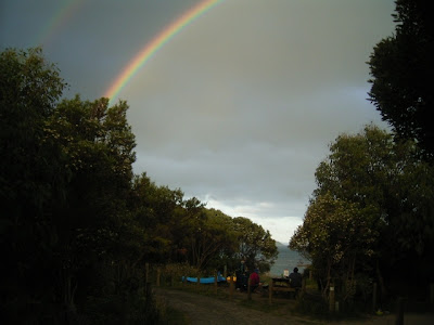
A double rainbow at Blanket Bay
The great 24 hour packing exercise is about to begin and it got us thinking about the differences in gear we take for a fixed camping trip compared to a hiking trip. They are, in our case , HUGE.
The comparison may be interesting for "Our Hiking Blog" readers
Bedding
Blanket Bay: a queen sized self inflating mattress, underblanket, sheet and a doona. Two pillows each
Hiking: Down sleeping bag and a 3/4 length thermarest mat each
Refrigeration
Blanket Bay: Two gas powered fridges, a Coleman 40 litre esky and another small esky
Hiking: nothing
Food and drinks
Blanket Bay: about four large boxes of food ranging from dips and chips to bacon and eggs. Several bottles of champagne, red & white wine, beer, spirits etc
Hiking: just enough food for each day, packaged carefully to avoid carrying extra weight. Some sachels of "tang" as a treat with water
Clothing
Blanket Bay: a large overnight bag each, 3-4 different pairs of footware, 2-3 towels each
Hiking: What we are wearing plus a few spares and cold/wet weather gear
Furniture
Blanket Bay: fold out chair each, tressle tables (two), coffee table, fold out tables (two)
Hiking: nothing
Reading material
Blanket Bay: about 6-8 books each, various magazines
Hiking: one book, selected for size and weight
Other junk
Blanket Bay: snorkling gear, wet suits, fishing gear, games, dish rack, washing up tub
Hiking: essentials, pocket knife, quick dry towel (maybe), first aid kit
Lighting
Blanket Bay: Coleman Lantern, headlight each, 12v fluro, 12v battery pack, candles
Hiking: headlight each
Transport
Blanket Bay: Our twin cabin utility with roof racks loaded, the back full and a hire trailer.
Hiking: The pack on our back and our legs.....simplicity.
Australian Alps Walking Track / Mt Howitt access - Latest information
There have been many hits on "Our Hiking Blog" looking for information regarding access and track conditions in the Mt Howitt area following the fires in late 2006. We are not very familiar with this area, but hope the following information is useful and points you in the right direction. If you are heading up that way this summer, enjoy.
We are subscribed to aus.bushwalking , an excellent bushwalking discussion group hosted by Google, and there are several posts discussing access to Mt Howitt and the Australian Alps Walking Track. The posts regarding Mt Howitt access are quite detailed. Australian hiking guru and author John Chapman is an active member, and he posted this information following a recent trip to the area.
John has indicated he is happy for the information to be reposted here. His excellent website is a great resource for anyone interested in bushwalking, ski touring, rock climbing and photography in Australia. We have several of his books.
This is John's report:
I have just returned from the area. I spent three days with the ranger
marking the AAWT track from Catherine Saddle through the Razor and
Viking to Barry Saddle.
Please don't remove the tape markers - they are essential at present for track workers to go in in 2 weeks time to cut all the logs and clear all the fire debris off the track. Track workers are not walkers and need plenty of tapes to make sure they dont get lost.
We ran out of metal triangle AAWT markers and Parks intend to rip down the tapes and put up more spaced new AAWT markers as soon as new markers get made. Without the tapes the track is currently impossible to follow. I knew where the track went hence why I was in helping Parks mark it.
Parks intend opening all of the AAWT soon - at present they have remarked some long sections between Mt Wills and the Cobberas and are working at clearing much of the regrowth from the 2003 fires and some of the fallen timber from the 2006 fires. It seems some significant funds were allocated by the government for repairing fire damaged tracks recently hence the activity.
Regarding roads, the road to Cobbler Lake from the Rose River is open and suitable for 2 wheel drives - needs care but is OK. Also you can come in from Stirling on the Circuit Road - they are doing some logging and sometimes close the road for a few hours as they load jinkers however if you know how timber workers operate its easy to miss the closed times.
Basically use the road in the afternoons and at night and its nearly always open - the timber workers start very early and finish by early afternoon most days.
According to the ranger the roads are also open down to Binadaree Hut and along the river to the Upper Howqua Camp - from there you can climb directly up onto Helicopter Spur or its a short walk to the base of Howitt Spur.
The road from the Circuit Road down to the King River is also fine at present for almost all vehicles.Past the river up the Staircase to Cobbler Lake - at present its very rough and 4wd only and if you value your 4wd or are at all tentative
about big rocks then don't use it - it took us almost an hour to drive
down it and the ranger knows the road - it was the roughest he has ever
seen it as recent thunder storms and flash floods in the last 2 weeks
have caused significant damage.
As for Brocks Road from the Upper Jamieson into the Howitt Car Park - the ranger has not driven it for a few weeks and was not sure whats its currently like given the damage he has seen on other roads recently.
My information is the Tamboritha Road will be closed for a long period as there is no road formation left through some gorge sections.
Note - if walking in the area expect to get pretty dirty from burnt
sticks and logs - the ash has not yet washed off. Some of the area looks
like it has been nuked but that's the exception. Overall, it will return
to something like its former state in a few years.
John Chapman
Mt Howitt and the Crosscut Saw to Mt Speculation
Snow in November in the Victorian Alps? That is only part of the story our guest blogger John has to tell in his great story about a walk on Melbourne Cup weekend. John has been on several walks with us since discovering bushwalking in the last few years. We have done the South Coast Track, Overland Track and the Great Ocean Walk together. If you look around the blog further you will see him starring in many photo's and stories. Many thanks John for your first foray into "Blogging".
It was my first walk with the Geelong Bushwalking Club, leaving Geelong in the evening of Friday 2 November 2007. The intention was to climb Mt Howitt, camp at McAlister Springs on the first night, then walk along the Crosscut Saw, past Mt Buggery and camping the second night at Mt Speculation, which I understood to have one of the best camp sites in the high country. We planned to return to the Howqua camping ground, via Stanley’s No Name Spur. I was eagerly looking forward to this trip, with people that I hardly knew or hadn’t previously met and had been advised that this one of the best walks, that the Victorian Alps had to offer.
We collected two people in Melbourne and after passing through Mansfield, arrived at the rotunda at Telephone Box Junction at about 10.30 pm, which is near Mt Stirling. The choice was to set up tent in the rotunda, sleep in the car or sleep on a mat on the ground, which is what I did.
The first stirring began at 6 am next morning and we were soon up and about and ready for the hour’s drive along Circuit Road to Bindaree Road, arriving at our destination (Upper Howqua Camping area) at about 8.45. We passed some deer hunters, who had several carcasses and a large pack of what appeared to be English type hunting hounds. They looked at us a bit suspiciously. After a quick change, we had our backpacks on and after a few false starts, decided that we had to cross the creek which I managed to do without getting wet feet, although I slipped on the bank and was grateful that I didn’t break my wrist in stopping the fall.
After walking about 2 klms along a fire track, we located the track up Mt Howitt. The walk leader seemed to have reliable track notes which impressed me. After Mt Buller (1805m), Mt Howitt is the tallest peak in the region. I found the upward climb relentless and the going pretty hard, not improved by light rain. The visibility was very limited, so we did not get reward for effort at the lookout points. It was obvious that the women in the party were more physically capable than I was and my pack felt heavy and I was struggling. After about 5 hours we reached what appeared to be the plateau and after passing Mt Magdala and walking along the plateau via West Peak, another hour passed before we reached our first destination (McAlister Springs) and the Vallejo Gantner Hut, at about 4 pm. By this time rain had set in and we were surprised to see the A frame hut still standing, after being informed that it had burned down in the fire. All of the tress around it had been burnt. Most of us elected to sleep in the hut despite a few leaks in the roof, some set up tents, with one moving inside as the rain got heavier.
The rain intensified over night and all through Sunday. It was pointless to proceed along the Crosscut Saw as the visibility was very limited and the conditions unwelcoming. We spent the day trying to keep a small a small fire going and discussing subjects such as what food to freeze dry and other subjects, whilst occasionally peering out at the hail and occasional snow falling. The door to the hut was very low and I knocked my head more times than I can remember. We met one other gent who said he was walking to Canberra, but appeared to have a very flexible plan with deviations as the mood took him. We met two other people who were father and son in law and seemed to enjoy each other’s company. We were also envious of their access to whisky and other creature comforts.
Most of the group had to return to work on the Wednesday, so it was not possible to wait out the weather and proceed to Mt Speculation. We discussed whether we would return to the cars on the Monday via the Stanley No Name Spur route, with the possibility of at least seeing the start of the Crosscut Saw or going back down Mt Howitt. We decided on the latter as being the quickest option. On the plateau, we walked through 4 inches of snow, with a strong wind blowing up the valleys and foggy conditions ensuring that we kept moving to keep warm. My hands were freezing and I decided I needed to invest in superior gloves. I noted that most wore their thermals, which I had rejected in case I got hot.
The walk down Mt Howitt was not easy, was a bit slippery and hard on the knees. The track disappeared in some places, particularly with the number of burnt and fallen trees, although the weather improved as we moved further down the mountain. At the end we had to cross the creek in several places, which was running faster and deeper than on our ascent. We arrived at the car with wet feet.
I was pleased to see that our cars weren’t surrounded by water.
After changing into dry clothes, we had some lunch and headed off to Mansfield for a pie, or whatever we fancied.
The leader of our group informed us that this was his second failed attempt at the Crosscut Saw and although there would be a next time, it should only be done with a favourable weather forecast. On the way home, we learned that the bridge at Licola had been washed away, which did not surprise us given the weather that we had experienced.
The group got on well together and I was impressed with the planning, the consultation during the walk, the navigation skills and attention to safety of the group.
Excellent Victorian Walking Resource
We were contacted recently by Bob Padula from Mont Albert, in the east of Melbourne letting us know about his walking related web pages and blog. We had a good look around this afternoon and discovered a gold mine of information that has been put together by Bob.
In Bob's own words:
I am a Professional Engineer, providing technical consultancy services in the area of high-frequency broadcasting - I graduated from the Royal Melbourne Institute of Technology in 1967, and was employed by Telstra Corporation until 1998.
I have been actively involved in bushwalking since 1954, and regularly undertake short walks around Greater Melbourne and nearer country areas. I also have a passion for digital photography, 4WDing along unmade roads, and exploration of parks, reserves, sanctuaries, coasts and mountains!
This Guide contains details of walks I have completed in the period from March 2005, and most can be completed by anyone with a moderate level of fitness. Some walks are suitable for persons with limited mobility.
Most walks described are located in the general area around Melbourne, but there are many further afield!
In publishing this free Guide, and sharing my knowledge and experiences through the Internet, it is with the hope that it will encourage readers to set aside some time to venture regularly into the Victorian countryside and enjoy the beauty and scenery which it offers, and at the same time support the development and maintenance of an appropriate level of fitness.
This is the link to Bob's comprehensive walking site : GUIDE TO SHORT WALKS IN VICTORIA I started counting all the walks that were listed and decided to stop at 100+ . Lets just say there are a LOT of walks described there!
Bob also keeps a Blog he describes as:
A Chronological Journal of my bushwalking activities, which is updated whenever I complete a new walk. My bushwalking is mostly short half-day journeys in Victoria, Australia, and the entries highlight the places visited, with some humor added! Here is the link - BOB'S AUSTRALIAN BUSHWALKING JOURNAL
Just have to say, great stuff Bob, excellent resources to encourage people to get out and about!
Continue Reading ....
Day 5 - Joanna to Ryan’s Den - Great Ocean Walk
We were fairly slow off the mark each morning, and today was no different. Deb again headed off in the car to meet us at Ryan’s Den. The rest of us threw on our packs which were getting a bit lighter by now and took off with the aim of reaching Ryan’s Den with plenty of daylight left in the day.

We hit Milanesia Beach following (in my opinion) a fairly boring inland dirt road and 4WD track section. Below is our lunch spot...very nice.
 We could not understand why it was able to be there as many houses had been demolished at Blanket Bay when the Otway National Park was declared. The hut was very well maintained, had gas bottles and a newish shed behind it. It was well furnished with 50’s furniture and had the grass mown around it. A GREAT position for a holiday shack, we decided as we explored around it and had lunch on the edge of the beach.
 The beach walking here was pretty good as the sand was not too soft and the wind had dropped since yesterday. We headed off up hill at the first GOW track arrow and had to do a fairly steep hill climb and then another steep down. We discovered if we had continued up the beach there was another GOW arrow up a track that would have saved the previous up and down. We were then faced with a fairly large climb up both track and stairs to reach Ryan’s Den Camping area. This seemed a long, long way and finally, after a couple of false starts we reached the camp sites.

That night, just on dusk, two other parties arrived (we remembered it was Friday) They were the first GOW walkers we had seen. Thankfully, even thought we had not camped in our allocated sites, these new people were happy to pick any site and camp the night. (Note to selves, we should have camped in the allocated sites)
Related Posts on the Great Ocean Walk
Blanket Bay hikers shelter
Our Hiking Blog goes "lightweight" at Blanket Bay
Drinking water on the Great Ocean Walk
Great Ocean Walk - the start
Marengo to Blanket Bay
Blanket Bay to Cape Otway Lightstation
Lightstation to Aire River
Aire River to Joanna
Ryans Den to Devils Kitchen
Devils Kitchen to The Gables
Great Ocean Walk

The Parks Victoria website describes the walk as:
One of the Worlds Great WalksThe Great Ocean Walk, on Victoria’s spectacular west coast, stretches 91 klms from the idyllic resort town of Apollo Bay to Glenample Homestead (near to the 12 Apostles). It passes through the beautiful National Parks and overlooks the Marine National Park and Sanctuary.

Special thanks to Helen and Deb for letting us use some of their photos.
Related Posts on the Great Ocean Walk
Blanket Bay hikers shelter
Our Hiking Blog goes "lightweight" at Blanket Bay
Drinking water on the Great Ocean Walk
Marengo to Blanket Bay
Blanket Bay to Cape Otway Lightstation
Lightstation to Aire River
Aire River to Joanna
Joanna to Ryans Den
Ryans Den to Devils Kitchen
Devils Kitchen to The Gables Continue Reading ....
Lake Elizabeth - Otway National Park
A warm up walk for the Overland Track AND we see a Platypus! A few of us went to Lake Elizabeth, near Forrest, for a warm up walk in preparation for the Overland Track in Tasmania in 10 days (yippee!!!) We walked a route that Colin and I had done late last year , with the plan to do about 15km. It was great walking except the track was often really greasy and a couple of us (me being one of them) fell. This broke my well loved and used walking pole :-( so off to David at Mountain Designs for a newy next week. The highlight of the trip was seeing a platypus on a little beach on the south side of Lake Elizabeth. We had decided to stop there for a break and were just chatting , waiting for a couple of stragglers to arrive and when I spied the platypus feeding right on the edge of the lake , burrowing its bill frantically into the edge in about 4 inches of water.
It was fantastic and just ignored us and fed for about 10 minutes. The next morning I told the Parks Ranger about it and he said he had not seen one there for 4-5 years.....made us feel very honoured that this great little creature chose to appear while we were there.
We had a very pleasant evening around the fire and then slept pretty well following a big day up and down those Otway hills and a couple of , yes to use the old term, well earned drinks.
A great short break and warm up for the main event in February.